Categories
Oregon Our Trips

Mt.Hood or Bust: Part 3

Saturday August 6th: Mitchell to Prineville and Prineville to Crooked River

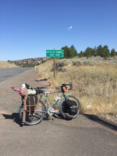
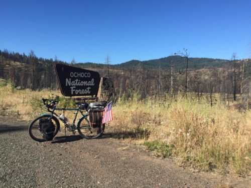
This was the day I had most been looking forward to. I had been dreaming about riding my bike to one of my favorite fishing spots for nearly the past 2 months. The day would not be without obstacles however. Long before I arrived in Prineville, the closest town to The Crooked River, I would have to climb Ochoco Pass. At 4,720 feet, it would be the steepest climb to date. Gradual at first, the climb begins as soon as you pedal out of Mitchell and continues on for nearly 20 miles. I had expressed my concern to one of the other travelers staying at the hostel the night before, his advice, just put it in the climbing gear and don’t stop pedaling, you will reach the top eventually. Simple yet true, my mantra was “just keep pedaling”. About two miles from the summit I was honestly unsure how much more I could push myself before taking a lengthy break. Just as I was looking for a spot to pull over a Subaru outback with Oregon plates passed me and as he did, he tooted his horn and stuck his hand out the sunroof giving me a big thumbs up. I kept pedaling all the way to the summit and then had a dance party to Katy Perry’s Roar.

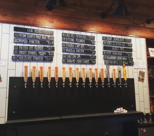
I took my time coming down the other side, although it wasn’t exactly the steep descent I had hoped for. I stopped at the Ochoco Reservoir, where I had considered camping when planning my trip, and used their day use area to change into my suit and take a quick swim to cool down. The campground was full of RV’s running generators and frat boys with loud music so I made the decision to move on. On my way out I ran into another solo bike traveler, Niko from Columbia who was traveling from Pittsburgh to Portland while on summer break from engineering school. I told him he should take a swim and if interested come meet me at the brewery in Prineville. It was 7 more miles into town and the lack of shoulder plus the weekend traffic made for some sore gluteal muscles, as I was clenching my cheeks out of fear the entire ride. Ochoco Brewing started in 2009 and currently has more than 10 of their own beers on tap as well as a few other local beers, I would highly recommend the Double Dam IPA. Being out on the road, I hadn’t gotten a chance to watch the Rio Summer Olympics yet and so I was excited to watch the US men’s basketball team take on China. They won despite DeAndre Jordan’s horrible free throw percentage and Carmelo Anthony’s poor excuse for defense. My new friend Niko joined me about an hour later and it was nice to have someone close to my own age to chat with about biking and the trials and tribulations of long days in the saddle.

After parting ways with my new friend, I rode to the store to resupply and get an Oregon fishing license. Bi-Mart is a magical place, if you’re not from Oregon you’ve probably never heard of the small chain store but I would highly suggest you make your way to the west coast just to visit this employee owned mercantile. The guest services lady was nice enough to let me bring Bertha inside and away from predators. I bought a two day license, some bratwurst, buns, chips and a 24 oz coors, they did not have PBR much to my disappointment. After I inspected my purchase I felt like I could have showed up at the frat party at Ochoco Reservoir and fit right in.  I headed to my own little oasis instead and couldn’t have been more excited. I told the guy at the check out what my plan was and he looked at me suspiciously, telling me it would take “at least 3 hours” to get out to the campground, at 15 miles away I highly doubted that and smiled while I was internally busting up laughing, sorry bud I might ride just a wee bit faster than that.

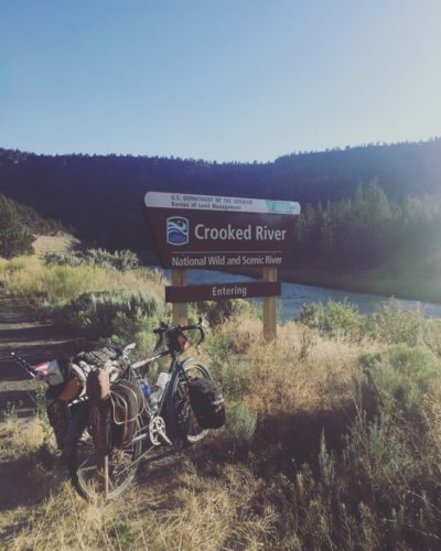
Scouting a river is so much more rewarding when you’re on a bike but also much more challenging when you are indecisive and want to see all the options before choosing. I eventually picked a campground, I’m not telling you which one because the first rule of bike fishing is “don’t give away the location”. I had been to this spot before, 25+ times in the past 4 years, but never had I come without waders and boy was that water cold! I scrambled around for high ground while fish jumped around me. As I settled into my cast I was hit with that classic wave of bike touring exhaustion and realized that the Coors was probably going to spend another day in the pannier. (Editor’s note: the Coors is still in the beer fridge at Bike Touring News)

Sunday August 7th Crooked River- Madras *the day I almost died*

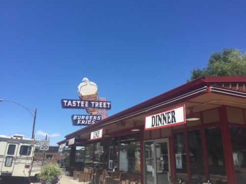
I had originally planned to stay an entire extra day at the Crooked River and fish to my little heart’s content but plans change. I was starting to get lonely and I made arrangements to meet a friend at the next campground for some girl time. As I loaded up and started pedaling back toward Prineville I was feeling out of sorts. I was kind of bummed to be leaving the spot that I had been looking forward to spending time at for the past 2 months. This was another lesson learned, only YOU are in charge of your bike tour and it would behoove you not let anyone interfere with that. I stopped in Prineville and got an ice cream cone, ice cream is the universal tool for making one feel better. I now had two options, call my friend and tell her that I was going back to the river and go another 30 miles round trip out of my way or I could keep going towards Madras and possibly fish the Deschutes River. I chose the later.

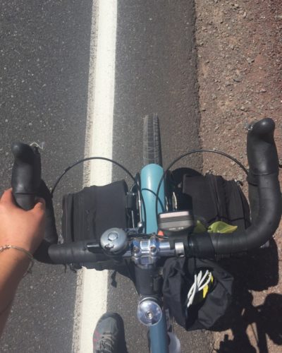
I left Prineville and quickly realized that traveling on HWY 26, on a Sunday, between these two towns was possibly the worst idea ever. A shoulder of under 2 feet, frat boys returning from the lake, pulling their Mastercraft ski boats, in a hurry to get back to their sorority girlfriends, and families hauling their motor homes or trendy tiny houses, speeding past me at 70 MPH, not to mention a head wind, because there is always a freaking headwind. I was scared shitless to say the least. After nearly being blown off the road by a course of these monsters, I looked up to see a man, compensating no doubt, with his giant diesel F350, charging right at me from the other direction. As he approached, inches from me, I was forced to bail into the ditch on the side of the highway. I stayed on my bike and was able to navigate to the next pull off before hyperventilating. I called The Bike Hermit, barely able to catch my breath and told him what happened. Note to self, do not call your parents and tell them you are in a situation that could possibly take your life. The panic button was pressed on the other end of the call and Sky King had already sprung into action before I could control my sympathetic response. The next call that came in was from a family friend who was an hours drive away and he told me he was getting in his truck and that I should send him my location so he could come pick me up. Whoa, whoa, whoa, wait a minute here, I never said I was done, I just said I was scared. I asked him to give me 30 minutes while I collected myself and thought long and hard about whether or not I wanted this moment to be the end of my journey. Eventually I decided it wasn’t, I had to keep going, I had to finish what I started and despite the pleas from my parents, I got back on my bike and back into the 2 foot wide shoulder of death. I made it to Madras alive, obviously or else I wouldn’t be writing this, and immediately asked Siri for directions to the nearest margarita. My friend met me in Madras and together we loaded up Bertha and drove 40 miles to Clear Lake Campground. We drank beers, listened to music and laughed until we cried, it was exactly what I needed.

Monday August 8th Clear Lake to Government camp

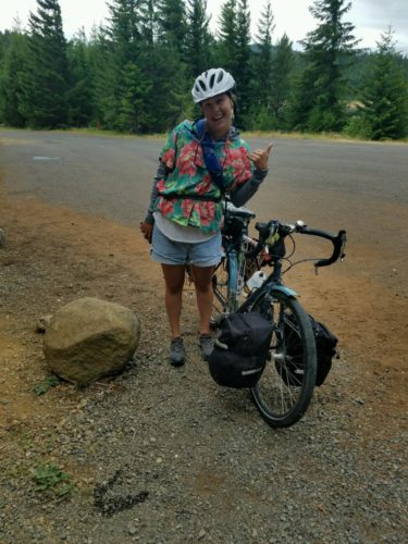
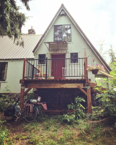
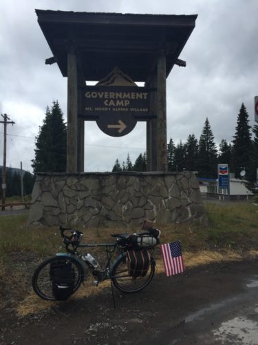
We woke early and I made my standard breakfast of oatmush and instant coffee as my friend made a disgusted look and took another bite of her protein bar. Today would be the last leg of my journey and I decided to wear my party outfit, button up Hawaiian shirt and cut off jean shorts, aka jorts. I immediately regretted my decision as it started to rain, typical pacific northwest summer. I had planned for the 90 degree days but not for the rain and so I was forced to accept the fact that I would be soaking wet in five minutes flat. I was only about 15 miles from final destination with a warm shower and roof over my head so I figured I would probably survive. I honestly can’t say much about this final day except that I was ecstatic to have reached my goal. I stopped to charge my phone and grab a cup of coffee at the lonely Chevron on hwy 26 before it becomes hwy 35 and I watched as tourists ran to and from their cars to avoid the rain. Emotions swelled as I rounded the corner and the sign for Timberline Lodge came into view. I have spent most of my adult life in and out of Government Camp Oregon and to me it feels as much like home as the town I actually “grew-up” in. As I pulled off to take a picture in front of the sign that welcomes you to the township locals lovingly call “Govy”, I cried tears of joy and thanked the stars above for allowing me make it this far. It would take hours for me to wipe the stupid smile off my face. I pulled up in front of the town bar, Charlie’s, and begged some random 19 year old kid to take my picture, I’m pretty sure he thought I was a crazy homeless lady but I honestly could care less at that point. I excitedly rolled the next two blocks to the cabin that I fondly refer to as “my happy place” and was greeted by my friend Tom’s dad who had been patiently waiting for me to arrive for the past week. The bicycle part of my journey had come to an end but the next few days would bring another type of journey. Friends would come from across the west coast to this magical place to celebrate the life of a friend, an annual event to remember our friend Tom who was taken from this earth far too soon. There would be tears, there would be laughter and there would be the type of bonding that only 10+ years of friendship can bring together and I would find myself feeling more at peace than ever before.
IMG_3374

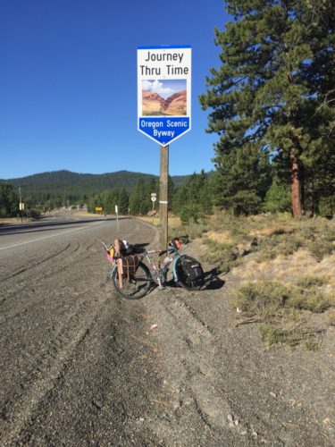
Nearing the top of Ochoco Pass

IMG_3377

Ochoco Brewery: 4 stars

IMG_3384

A good place to spend a Saturday night
IMG_3385

Classic small town burger joint. Excellent mint chocolate chip ice cream
IMG_3389

The “death trap” that is Highway 26

IMG_3399

Party attire (yes I wore bike shorts under the jorts)
IMG_3393

We made it!!!


IMG_3398


My happy place

Technically this video is from day 3 but it’s a good closing note
Categories
Oregon Our Trips

Mt.Hood or Bust: Part 2

Thursday August 4th: Prairie City to Dayville

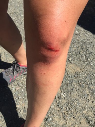
The ride to Dayville was easy enough, a “flat” road and very little wind allowed me to easily make the 44 miles in just under 4 hours. I had pretty big expectations for Dayville, The Bike Hermit had gone through these parts in April and loved it. By the time I reached town at around 11:30am, it was already 85 degrees and shade was rapidly becoming sparse. I pulled off into the RV park to fill up with water and get my bearings. I knew that there was a hostel in town but wasn’t sure as to where. I googled directions and began climbing a short but steep hill to the left of the main street. I was starting to doubt the directions Siri had provided so I decided to stop and double check my location. With legs like jello, clipping out of my pedals was much more difficult than anticipated, combine that with the steep incline and it took about 5 seconds for me to end up on the ground, left foot still attached to the pedal. I collected myself and decided to just go back to the RV park and ask for directions from a real live human being. I stopped at a church in front of the park to wipe away the blood that had begun to run down my leg and pool in my shoe. Now whether you’re in the medical field or not, you can probably gather that if someone is bleeding from their knee, they’re most likely not in the greatest mood ever. The RV park host apparently didn’t get this message and informed that I needed to pay the $10 or leave. I was on the verge of crying at that point, mostly out of frustration, and told him I would if he gave me directions to the hostel. He pointed up the road behind me and so with blood still leaking from my wound, I pushed my bike up another small hill and into the yard of the Dayville Presbyterian Church.

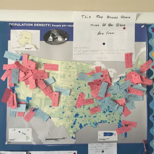
The Church has played host to bicycle tourists for over 10 years now and the map on their wall shows that people have come from all over the world to ride their bikes into Dayville. While the “host” herself does not reside in the hostel, she did let me know that the rules are to be strictly followed, and reminded me that  “he is always watching”, meaning that god would know if I drank my beer in the shower, even if she didn’t. So I unloaded my panniers and took my PBR tall boy to the park where I could soak my sore legs in the South Fork of The John Day River. The town of Dayville is small but has all the necessities, one restaurant, one grocery store, a post office and even a small bicycle repair shop. The city park hosts a dual tennis court, basketball court combo, just make sure to remove the tennis net before attempting a full court press. Upon returning to the Hostel later in the afternoon, I found that a large group of trans-am riders had arrived. Varying in ages from 11 to 45, the group was on their last leg of a cross country tour. They had all but entirely moved into the shared living space and so while I went around moving my things out of the way I attempted small talk. Turns out they were averaging about 80 miles a day and scoffed when I told them I had come from less than 50 miles away that day. I started to feel defeated and weak. I felt like a wuss and I felt that even though my friends on Facebook seemed impressed, maybe I wasn’t doing anything that special after all. Bike touring is 80% mental and this minor incident, to me, was equivalent to pulling a hamstring muscle. I quickly refilled my water bottle and grabbed my book, I wanted to get as far away from these obnoxious overachievers as quickly as possible. I ended up sleeping outside that night, apparently these guys ride hard and then party hard and at 10 o’clock they were still wide awake singing campfire songs, probably just to be annoying.


Friday August 5th: Dayville to Mitchell

After a restless sleep, I packed up quickly and hit the road just as the sun was coming up. I was expecting a pretty hefty climb for the day and didn’t want to tackle it in 90 degree weather. The pass was gradual and although 75% of my day was spent on an incline, it really wasn’t all that bad, physically. Mentally however, I continued to struggle. As I mentioned before, I had planned to be in Montana, riding my bike to Bozeman. I was planning to ride to my nursing school graduation. I was flooded with emotion about should of, could of, would of situations, along with the feelings that my 40 mile days in the saddle were less than impressive. By the way I’ll still be graduating, it will be in December though so a bike trip across Montana in the middle of winter might be slightly more difficult. When I made it to the top of Keyes Creek Summit, I was so ready to be done for the day. Right before I reached the summit, another tourer had just reached the top and was making his way down into Dayville in the opposite direction. He looked over and I waved enthusiastically. He shouted words of encouragement and told me to stop at the hostel in Mitchell because it was “totally awesome”. I had already arranged to stay there and I was now even more excited to be heading down the hill into town.

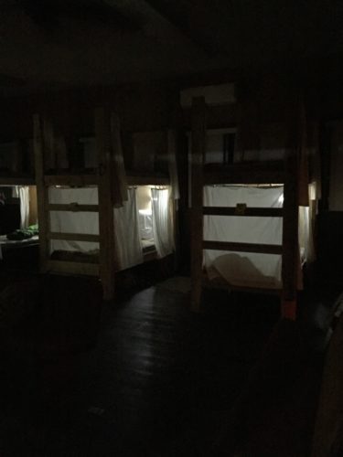
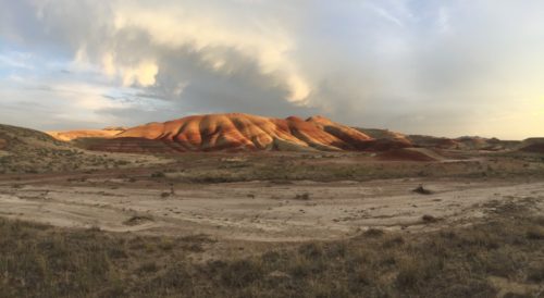
The town of Mitchell resembles that of a deserted mining town, old wooden buildings house a grocery store, a restaurant and a trading post. Don’t let it’s size fool you though, with a population of just 130 people, Mitchell is happening place. Tiger Town Brewery, officially opening fall 2016, currently consists of a small camper trailer turned hot wing cart along with several shade covered picnic tables. With free wifi, honky tonk tunes on the radio and a few local beers on tap, I was fully satisfied to spend the rest of my afternoon here. Prior to my adventure into town, I had stopped by to check in at the Spoke’n Hostel. Right off the bat, Jalet was more than accommodating. Along with 6 bunk beds, the hostel has a fully stocked kitchen, two bathrooms and an outdoor shower and firepit all for a suggested donation of $30.00. She was also kind enough to offer a tour of the Painted Hills, one of the seven wonders of Oregon. She totes cyclists the 15 minutes at sunset in her Subaru Outback and ensured me that it was an event I wouldn’t want to miss, I didn’t admit that I had been looking forward to going for years. I came to share the cozy old church with 4 other cyclists, a couple from Holland and two guys on cross bikes from Portland. It was a relief to spend time with people who were positive and encouraging about bike touring and who held the same philosophy as myself, that it should be fun. I loaded up with Peter, Marika and our host at 7:30pm to head out on our field trip. Breathtaking is probably the only word I can come up with to describe the amazing scenery of this part of Oregon. Layers of earth, millions of years old, have been exposed to reveal layers of rust colored earth mixed with the brown desert background leaving the landscape to look almost unreal, like a painting. Ice cream sundaes topped off the evening and I slept soundly for the first time since starting my trip.

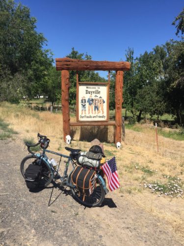
IMG_3296

Welcoming image of Dayville Oregon

IMG_3297

It ain’t bike touring without a little blood

IMG_3301

Map at the Dayville Hostel. So far I’m the only one to claim Montana

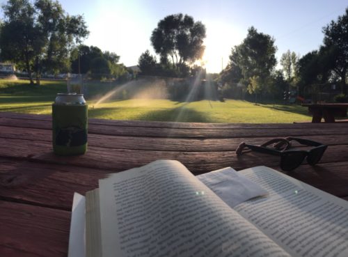
IMG_3314

Enjoying the Dayville City Park with a Three Creeks Hoodoo Voodoo IPA

IMG_3327

Keyes Creek Summit outside of Mitchell Oregon

IMG_3370

Cozy sleeping quarters at The Spoke’n Hostel

IMG_3336

The famous Painted Hills

Categories
Bike Touring Tips Oregon Planning Resources

Mt.Hood or Bust: Part 1

A year ago, I began planning a bike trip. I planned to ride from Great Falls Montana to Bozeman Montana, but plans don’t always go as expected, “you’ll have this” as The Bike Hermit would say. So instead, on August 3rd, I found myself, on my bike, riding across Oregon towards the unincorporated community of Government Camp, 60 miles from Portland. After a stressful academic year learning to accept that sometimes plans change in ways that aren’t necessary appealing, a solo bike trip is just what I needed. I typed “Boise to Portland by bike” into google and I began working on my route. I figured I’d give myself a little over a week to get there. An annual reunion starting on the 11th of August gave me a timeline to stick with. As the departure date drew nearer, fire season was underway in Idaho and thick smoke loomed in the air. I had to changed plans yet again and rewrite my route to allow for a start in the mountains outside of Baker City Oregon, hoping to avoid not only the smoke but also the 90 degree temps expected over the next few days.

When planning, and re-planning, a route, you want to make sure you are honest about the number of miles you believe you can physically handle in a day. I picked 50, knowing that I could average 10 miles per hour and had previously accomplished 40 miles per day without dying. So with the number 50 in mind, I began looking for towns and/or campgrounds that could serve as starting and end points for my 8 days of travel. Realistically, I knew I could go 2 days without a resupply area, as long as I could track down water, I could carry all the food I would need and be perfectly happy without having to interact with other humans. I also tried to plan for the unforeseen circumstances that would prevent me from reaching my destination for the day, this meant making sure there were places to stop and spend the night in the middle of nowhere if necessary. My best advice for someone planning a trip like this, don’t expect everything to go smoothly, don’t expect to be at the destination that you’ve chosen on time, or even at all, learn to expect the unexpected.


Prep:

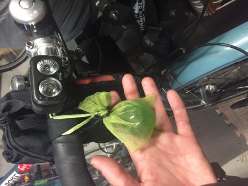
A lot goes into packing for a bike trip, The Bike Hermit was kind enough to share his trusted list of necessary items with me and I carefully weighed each one out and laid them on the floor of our garage. Considering that I have a Surly Long Haul Trucker with a 52cm frame, the standard Shimano XT-T780-L SGS rear derailleur, rear tubus logo evo rack, front tubus nova rack, Lone Peak panniers, and adding the weight of my packed items, my bike weighs exactly as it should. It weighs enough to carry everything I need for 8 days but not so much that I won’t be able to pedal it up steep mountain passes. So no, I didn’t weigh my gear or my bike and I honestly have no intention of doing so in the future. I made sure everything would fit into the two front Lone Peak panniers and two rear Gilles Berthoud panniers. I made sure I had enough food, enough water and enough items of clothing to be comfortable while riding and in camp. I did carry one extra item however, nothing necessary to be physically successful persay but essential to make my journey emotionally possible, a glass green sphere. Given to me by a close friend, it is meant to represent the spirit of a my friend Tom who passed away 11 years ago. Each year, a group of us meet to celebrate his life on the side of Mt.Hood and this bike ride would serve as a form of meditation as I reflected on the past year’s trials and tribulations as well as the 10+ years spent without my friend.


Day 1 Wednesday August 3rd: Wallowa-Whitman National Forest to Prairie City Oregon


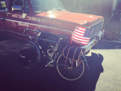
High in the mountains above Baker City Oregon, I had a frosty start. The only downside to traveling with a hennessy hammock as opposed to a tent is that trees are required for set up. The Wallowa-Whitman National Forest provides plenty of trees but in adequate spacing and the bend of the young saplings meant that no matter how hard I tried, I would end up sleeping on the ground. After instant coffee and instant oatmeal, I loaded up bertha for our first solo travel. The Bike Hermit had installed a large dollar store American flag to my rear rack the night before so sleeping bag, rear panniers and fly rod were carefully placed as to not disturb it’s placement. Photos were taken by proud parents and well wishes were given before I unceremoniously pedaled away, uphill, into a headwind.

I was giddy with excitement about being out on my own. It’s not as if I haven’t done many things on my own before, I’m almost 30 and have been living on my own since 19, but somehow this felt different, like suddenly I could eat all the cake and ice cream I wanted to, watch scary movies and stay up as late as I wanted. So what does that translate to into a world where your parents are bike touring legends. It means you can complain out loud to yourself as much as you want, it means you can stop whenever and wherever you feel like it and it means you don’t have to listen to The Bike Hermit say, “you’ll have this”. So off I went up the hill with a refreshing breeze nipping at my face. I stopped to take off some layers at the top of the first hill and in the distance I could see another cyclist pedaling uphill in my direction. I got so excited about waving and saying “Hi” that I almost biffed it in the deep gravel of the slow vehicle turn off.

I was immediately impressed by the hospitality towards cyclists in this part of Oregon. Wide shoulders allowed me to feel comfortable on the road and nearly all of those who passed me slowed and/or gave me the lane, it was truly impressive. About 20 miles into my ride, ODOT was doing some work on highway 7. Several big trucks were hauling sand from their main site to somewhere up the road. About 200 feet from the turnoff to their main “dirt site” someone had constructed a pictograph of a water tap and a bicyclists, indicating that water was available and well as ample shade for taking a break. While I didn’t stop, I was happy to see this level of accommodation. Not long after this, I stopped to pee and while I was waiting for aforementioned large trucks to pass, one of them slowed to a near stop to inquire as to whether or not I was “broke down”. Again, this level of hospitality towards cyclists is just unreal and very much appreciated. I made it to my destination of Bates State Park around 12 noon, my expected arrival time for 38 miles of travel. While they had excellent hiker/biker spots, the generator running the sprinklers was enough to lead me to take over the day use pavilion. I made myself a biker fish taco, tuna on a tortilla, and pulled out my book to read. I was sound asleep within 30 seconds and found myself blinking awake nearly 2 hours later. It was still relatively cool and I felt reenergized. I took a look at my route map and decided I could push on a little further for the day. There were plenty of campsites and towns dotted along the route, making it possible for me to go anywhere from 10 to 40 more miles for the day. I recalled a mental note of The Bike Hermit explicitly telling me that “it’s all downhill from Bates to Dayville”. If you’ve read my previous blog, you’ll recall that the first rule of bike touring is that there is no such thing as “flat”, and relatively little “downhill”. So the first 10 miles found me climbing a mountain pass and cursing my father under my breath. I was relieved however when I reached the top and indeed, the rest of the way into Prairie City was literally all downhill.

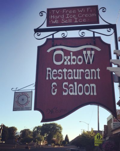
That little kid feeling took over again as I pulled into town, realizing that I could choose where to set up camp, where to eat dinner and eat all the ice cream that I wanted. While it wouldn’t normally be my first choice, I found a comfortable RV park on the edge of town. With the spaces having been built to accommodate for motor homes and fifth wheels, a cyclist will find themselves out of their element. The lack of trees forced me to use my rain fly as a tarp and prepare to sleep on the ground. There were a few trees across the creek and given the chance to do it over again, I probably would have asked the camp host if I could use them to anchor my hammock. The major perk of staying at an RV park is showers! Since it was my first day on bike, I wasn’t exactly at filthy hippie status yet but I decided that rinsing off the sunscreen and bug spray would probably allow me to sleep more soundly. The Bike Hermit had given me some solid advice about always carrying quarters for this exact purpose. I did not however have enough quarters to even get the water started. $1.75 for 10 minutes of shower time seemed excessive. Who needs a freaking 10 minute shower, especially when you are at an RV park, this isn’t the prom people, just rinse off and get it over with. I thought they should have some sort of system like the do-it-yourself car washes, you know put in a quarter for like 30 seconds of water, I could get behind that. After taking a PTA bath and successfully freaking out the family in the campsite next to me I rode into town to find food. Second rule of bike touring, always stop when there is food. When I ride into town, I usually put my trust in the other inhabitants of the camp and leave my panniers and camp gear set up at my site. I don’t travel with a bike lock as it would take up too much room, not to mention weight. Most businesses are okay with you pulling your bike inside, as long as there is room and you bat your eyelashes a few times. I took a Surly Junk strap with me and even though any half witted criminal could probably figure out how to unhook it, I wrapped it around my front wheel and frame and parked it outside, within viewing distance of my table. The Oxbow Restaurant offers one of the best mushroom swiss burgers I’ve enjoyed to date, which is saying something, trust me, and serves strong cocktails in mason. I always appreciate that hipster edge in the middle of nowhere oregon. After dinner, I  decided to explore the town of Prairie City. It didn’t take long, as the town consists of one main block and not much else. I noticed that they sold single cans of tall boy PBR’s and so I made my purchase of one beverage and one ice cream sandwich before returning to camp. At some point during the 3 block ride, a wave of exhaustion hit me and I made the decision to get in my sleeping bag without opening the PBR.

IMG_3259

Ready to hit the road

IMG_3250

The spirit of Tom

IMG_3254

Fully Loaded

IMG_3272

Sumpter Junction

IMG_3289

Best restaurant in Prairie City

Categories
Advocacy/Awareness Idaho Our Trips Tours and Rides

Riding The Weiser River Trail

Early last year, a friend of mine (who happens to live in Weiser) mentioned the existence of the Weiser River Trail. I had never heard of it, so I went online to check it out. (Mash here for the main web site. There is also info at the National Recreation Trails site, and the Rails-to-Trails Conservancy)

So, in mid-June of last year, my wife and I and two friends decide to check it out, so we drove out to Weiser and took a short spin on the lower part of the trail, beginning at the Weiser trailhead, which is located a few blocks east of US 95 on Main Street in a residential area. It took us just over an hour to get to Weiser from Boise.

It was a nice jaunt, made tolerable by overcast skies and cooler temps. This part of the trail wends its way through a valley that is mostly farmland. It’s flat and open, but scenic. We rode to the canyon mouth near Galloway Dam and the Presley trailhead, where the trail turns north from its formerly east/west alignment, then turned around and headed back. The round trip was about 16 miles.

Vehicle access to the Presley trailhead is via Weiser River Road. If you turn east on Park St., which is the only traffic light on US 95 in Weiser, it turns into Weiser River Road near the edge of town.

Our initial impressions of the trail were that it was uncrowded, there is very little shade along the way, and it’s pretty rough in spots. Being a Rails-to-Trails conversion, there was still plenty of railroad ballast on the roadway. It mostly consists of what looks like 2” crushers. You definitely want larger, softer tires on this trail.

This year, we decided to tackle the trail again, and try out different sections, as it was reported to us by some locals we met at the Weiser trailhead that the trail conditions improve as you travel further north. Of course, we met them AFTER we just finished our ride, so it was too late to move on up the road to another location. Lunch and liquid refreshment were the order of day at that point.

Memorial Weekend 2016 – Weiser to Thousand Springs Creek

I somehow convinced my son to join me on a camping trip on the trail. Paying for the requisite improvements to his bike (thanks, Jim!) probably didn’t hurt. We loaded up our gear on Saturday morning and headed out with high hopes. My friend who lives in Weiser agreed to let us leave our car in the street by his house, so it wouldn’t be sitting at a trailhead for multiple days (what can I say, I’m paranoid). This added another 2 miles to the ride at either end, but we got a scenic tour of the town of Weiser that way.

We got on the way shortly after noon, and after a couple miles on the trail we decided to cut over to Weiser River Road for a smoother paved road ride, so as to stave off saddle soreness as long as possible. We did encounter some interesting-looking local fauna on that leg of the trip, too.

(Note strategic placement of thumb shifter in photo. Composition is everything!)

We rejoined the trail at Galloway Dam and carried on from there. From this point, all the way to our campsite and back to the dam the next day, we never saw anyone else on the trail. We did encounter a group of kayakers who told us about the campsite we stayed at (“..it’s only a few miles up the trail!”), and they mentioned that they had ridden the trail the previous weekend when it was a muddy mess from a recent storm. They indicated that they liked it that way, too.

One thing about this whole leg was that there wasn’t much in the way of easy access to the river. I was carrying a Katadyn filter and towards the later part of the afternoon I was starting to wonder when I might be able to refill our water bottles. Fortunately we encountered our campsite shortly after, and it included a small beach where you could pump water pretty easily.

The campsite is improved, and is in a small section of BLM land. It includes a fire pit, picnic table, bench, and a porta potty a short ways down the road (so you don’t have to smell it). It is located at Thousand Springs Creek.

Looking north

Looking south

Here we spent an uneventful, if slightly uncomfortable, night. This was mostly due to not having super nice sleeping pads, but it was also pretty windy and noisy all night long.

The next morning we got up, had breakfast, packed up, and headed back. We might have gone further if we felt more rested, but the slow going (for us) road conditions and a late-ish start the previous day convinced us to call it a trip at that point. I had hoped to get to Midvale the first day, but we didn’t quite make it. That’s about ten miles further along.

The butte on the other side of the river the next morning, to the NE of the bridge. We saw some goats grazing on the hillside the previous evening, along with a fox that took off like a flash when it spotted us.

Taylor fiddling with something on his bike prior to departing.

If you like this kind of scenery, the Weiser River Trail has oodles of it!

Taking advantage of a rare spot of shade for a snack and a drink.

No strollers or roller-bladers here! Eat your heart out, Boise Greenbelt. Taylor is up ahead doing his Roadrunner impersonation. Meep! Meep! (We used to live in NM, so we know that roadrunners don’t actually run very fast.)

Midvale to Cambridge, June 19th (Father’s Day)

Leesa and I decided to be anti-social and head out on a fine Father’s Day Sunday for another section of the trail. This section features more farmland, and a short but interesting part that goes through a canyon right before you arrive in the thriving metropolis of Cambridge.

The trail conditions along here are better than the southernmost section, for the most part. It’s still a dirt trail, no matter how you slice it.

The trailhead at Midvale is at a nice shady park with water and a porta-potty. There’s a nice restaurant at the south end of town, too (about 200 yards from the trailhead – Midvale is not very big).

The round-trip distance worked out to about 18 miles.

We saw two does, or we saw this one twice. We also saw a really nice 4 point buck just south of Cambridge, but he ran off before we could take a picture of him.

Leesa having a rest in the shade at Cambridge.

Looking south from Cambridge trailhead. The Washington County fairgrounds are on the left. Leesa is the pink speck.

Just south of Cambridge looking south, just before the canyon.

Out in the farm country between Cambridge and Midvale.

Evergreen Campground trailhead to Tamarack (July 17th)

Wanting to see some different scenery, we opted to take a trip up into the mountains and ride the top section of the trail. There is a trailhead inside the Evergreen campground, which is up in the mountains a short ways from Council on US 95 – maybe 20 minutes drive time. The main trailhead at the northern terminus of the trail is at Tamarack, but the trail extends a short ways further from there. The Tamarack trailhead is located off to the east side of 95 just slightly north of the lumber mill. There is a road going into a meadow, and the trailhead parking area is back about 3/8 of a mile and features lots of parking, horse thingies, a pit toilet, water, and a picnic table.

We parked at Evergreen and rode up to Tamarack and back down, which is about a 13 mile round trip. There is some climbing on this section (beyond the 2% grade that you’re already climbing), especially right near the lumber mill. There is a lovely spot there with some steep switchbacks which are covered generously with loose gravel. Going up isn’t a problem, but coming down requires a steady hand.

This part of the trail is smoother than some of the more desert-like sections, and has more shade, since you’re up in the mountains.

Unfortunately, we left the camera in the car that day, so we don’t have any pictures from this segment.

Council to Fruitvale (August 6th)

This was supposed to be Council to Evergreen, but the weather forecast for Council was way off on the web (thanks, Intellicast!), so we had to cut it short due to high temperatures. It’s too bad, because just past Fruitvale the trail takes some serious bends and then heads up into the hills. We’ll catch that section some other time.

The Council trailhead is easy to get to. Just turn left in downtown Council right where the highway takes a hard right turn, and just follow that road as it winds to the right. The trailhead is easily visible just up on the left, and features a covered table and a porta potty cleverly hidden behind a storage shed on the other side of the road. If you head north on the trail, you will see it on the right.

This section was pretty much farmland, but did have lots of apple trees and huckleberries growing right along the trail. (The apples were definitely all “organic,” if you know what I mean.) The trail mostly runs straight right through to Fruitvale.

Just south of Fruitvale, looking north. Much of the visible shrubbery along the trail right here has fruit on it.

A hot and tired Leesa, ready for a ride in an air-conditioned car. Note the shed in the background – the porta potty is right behind it.

We haven’t been on the Cambridge to Council section but apparently there is a hot springs along there. After riding in 95 degree weather, a soak in hot water didn’t sound all that great, but later in the year it might be much more appealing.

To Sum Up, and some random blathering about printed materials

The Weiser River Trail is a nice change of pace and scenery from some other local trails, like the Boise Greenbelt. It’s close enough to get to with a relatively short drive (relative to driving up to Coeur d’Alene, for example), but far enough and unknown enough to provide some solitude while out riding. It’s also long enough to provide multiple opportunities to ride it without seeing the same thing twice, unless you just have to do the whole thing all at once. The other nice thing is that all the access to the trail is along US 95 north of I-84, which is a scenic drive and not as winding and congested as Hwy 55.

If you are an old fashioned type who likes paper maps, the BLM 30 x 60 minute (1:100,000 scale) maps are a good resource. The two that cover the whole trail are McCall and Weiser. These maps are available for $4 each at the Forest Service offices on Vinnell Way across from Walmart, and across from NIFC on Development Ave. over by the Boise airport. Just remember that they still show the trail as railroad tracks, and you’ll do just fine.

Other resources include a nice brochure about the trail, if you can find it. They have them at the Colonial Motel in Weiser, which also provides a shuttle service for cyclists. I haven’t used it, so I can’t say much more about that. They are on Main St. west of 95, near the McDonald’s restaurant.

Save