Categories
Other

Now Hiring! Join our Team of Bike Travelers!

Bike Touring News is growing and we are looking for passionate bike travelers to join the team!  If you enjoy helping folks solve problems and break down barriers so they can get out and explore their world on two wheels we want to hear from you!

Mostly, we need help with the daily operations of our Boise, Idaho retail store.  Some places might refer to such a person as a Retail Associate or Customer Service Representative but we’d rather think of this team member as an Adventure Consultant.

Actual touring/bikepacking experience is required, as are excellent communication skills (mostly listening), kindness, patience and a sense of humor.  Previous experience in outdoor/bicycle retail is an asset but is not required.  Must love bikes, people and dogs.

We are dedicated to building a fun-loving, adventurous, inclusive culture and providing a workplace that reflects those values.  If you want to be part of that process and help us grow the bike travel community here in Idaho and around the world, we encourage you to apply!  Know someone who would be a great fit?  Send them a link to this post!

Read on below for the Job Description and Application Instructions!  Please read the entire post (especially the How to Apply section) and follow the instructions if you intend to submit an application.


Job Description

Position Title:

Adventure Consultant

Location:

Bike Touring News HQ – Boise, Idaho

Start Date:

ASAP (Late July 2021)

Schedule:

Highly Flexible.  ~20 hrs/week to start.  Potential to transition to full-time once fully trained.  Normal shop hours are 11 – 6, Tuesday – Friday.  Some work may be available outside of retail hours.

Wages:

Hourly rate is negotiable based on demonstrated skill and experience.  Wage increase after six weeks training is completed and every six months thereafter pending performance review.  Potential for bonuses/perks based on performance.

Benefits:

Flexible schedule with ample time off for holidays, riding and travel.

Opportunities to participate in, lead, guide, and organize rides, events, campouts, etc.

Access to employee pricing on bikes and gear.

Bike commuting incentives.

Opportunity to be part of building and evolving a culture, brand and company based in the power of bike travel.

Role and Responsibilities:

The Adventure Consultant is on the front lines of our mission to empower the bicycle traveler.  This person will be laser focused on customers’ needs and experience, helping find solutions, solve problems and break down barriers so they are able to live their pedal-powered dreams.  Our customers are family and we treat them as such.

Typical daily responsibilities will include merchandising, cleaning and organizing retail space and backstock, facilitating bicycle test rides, providing assistance choosing bags, racks or other gear, answering phones, scheduling appointments and other common retail tasks.

There are a multitude of potential areas for growth depending on the individual’s skill set and aptitudes.  These may include but are not limited to mechanical work, content creation for web, blog or social media, shipping/receiving, inventory management, web order fulfillment and other e-commerce tasks.  We’re looking for someone who is enthusiastic about sharing the joy and wonder of bike travel with all kinds of people and who is ready to grow with us!

Required Skills/Experience:

Bike travel experience is mandatory.

Excellent communication skills (mostly listening), kindness, patience and a sense of humor.

Friendly, helpful and professional demeanor in person, over the phone and in written communication.

Strong code of personal ethics and the ability to treat all people with dignity and respect.

Fundamental understanding of bike fit and sizing.

Fundamental understanding of mechanical concepts relevant to bicycle design, assembly and maintenance.

High level of organizational skill and fine attention to detail.

Must love people, bikes and dogs.

Preferred Skills/Experience:

Retail experience (merchandising, point of sale, inventory management, etc.) is a massive plus.

Hands on experience with the key brands/products/services BTN offers.

Knowledge and understanding of relevant trends in the bicycle and outdoor industries.

E-commerce/web design experience.

Event/ride planning, promotion and leadership.

Content creation skills – photography, graphic design, social media, etc.

First Aid certification, Leave No Trace training or other outdoor leadership training.

About Bike Touring News

Bike Touring News was founded in 2011 with the mission of Empowering the Bicycle Traveler.  Many things have changed since those early days but the mission remains the same.  We are dedicated to providing our customers with the goods, services and information they need to ride and use their bicycle more of the time, whether that means riding to the corner store, to work, on an overnight camping trip or across a continent.

To that end, we operate a web store that ships goods all over the world along with a physical retail location and full-service bike shop in our Boise, Idaho headquarters.  We also strive to provide helpful, informative and entertaining content via our social media and blog platforms.  We leverage our knowledge, experience and passion to provide the best possible customer service and share the stoke of bike travel with our current and future customers, here in Boise and around the world.

While our mission and goals may be large and lofty, we’re actually quite a small business.  Our retail showroom is less than 300 square feet and we are currently a team of five, including Cheddar the shop dog.

How to Apply

Your application should include the following components:

  1. Your resumé (no more than two pages) outlining relevant skills, abilities and experience.
  2. A cover letter (no more than 1000 words) describing what got you hooked on bike travel and what motivates you to share that passion with others.
  3. Three brief descriptions (may be incorporated into resumé or cover letter) of bike trips you’ve taken in the past.
  4. Three references who can speak to your stated skills, abilities and experience.

You may deliver these documents via email, USPS or in person.  Primary consideration will be given to applications received by July 16.  Send your application to:

[email protected]

-or-

Bike Touring News – 3853 N. Garden Center Way, Boise, ID 83703

Thanks for your interest!  We look forward to hearing from you!
Categories
Other

The Owyhee Pedal Patrol Wants YOU! OPP North Fork Campout – October 11-13, 2019

The Owyhee Pedal Patrol Story

The Owyhee Pedal Patrol is a group of volunteers assembled to explore, share and contribute to the responsible management of the amazing region that is defined by the Owyhee Canyonlands Wilderness Area.  This rugged landscape in southwest Idaho contains six individual wilderness areas totaling over a half-million acres, encompassing some of the deepest canyons and wildest rivers in the world.  Our friend and co-conspirator Evan Worthington is the BLM’s field ranger in charge of patrolling this vast expanse.  That’s one lone ranger tasked with covering a half-million acres of territory!  The Owyhee Pedal Patrol was formed in 2014 as a force multiplier for Evan and the BLM.  We are not enforcement officers.  Our mission is to ride the boundaries, cherrystem routes and occasionally venture on foot into the wilderness areas to make a record of what we find so that these special places can be managed using accurate, up-to-date information.

Our goal for the coming year is to have at least one group of volunteers on an OPP ride every month.  In order to accomplish this goal, we need to deepen the pool of riders.  Hopefully that is why you’re reading this post!  If you enjoy rugged landscapes, challenging riding, self-supported bike travel and want an opportunity to experience all of the above via a free shuttle from the BLM, OPP WANTS YOU!

Volunteer Requirements

Owyhee Pedal Patrol riders must meet two primary requirements to be cleared to volunteer through the BLM:  1) Participation in a Leave No Trace training program and  2) a BLM-approved First Aid certification, both within the last year.  We strive to offer annual or bi-annual trainings (usually in the fall or winter months) through the OPP to keep those certifications up to date.  This North Fork Campout will check both boxes – clearing new volunteers to join the OPP ranks.

Please note that the First Aid training provided at this event is not sanctioned by the Red Cross or any other medical agency.  It is only valid as clearance to volunteer for OPP.  If you discover an interest and want to take your training to the next level, we highly recommend signing up for a Wilderness First Responder course via the National Outdoor Leadership School (NOLS) or a similar course focused on providing emergency care in remote areas.

You’ll also need to provide your own bike, gear and supplies for each trip.  Most riders would agree that the ideal bike for the rugged, unmaintained terrain of the Canyonlands is a wide-tired off-road touring bike like the Surly ECR.  However, riders have participated on everything from pavement touring bikes to full-on fatbikes, full-sus MTBs and even longtail cargo bikes.  If a bike and/or gear is a barrier to participation please email [email protected] and we’ll see how we can help!

Daily mileage and route difficulty is highly variable and can be tuned to the needs of a given group.  Base camping with unloaded day rides is an option but this region is best experienced via a self-contained through-ride or loop.  We’ll always err on the shorter/easier side if in doubt as conditions can change rapidly and “desert miles” often feel much longer!  As is the case with the North Fork Campout, we’ll typically shoot to depart from BLM HQ in Boise on Friday afternoon to shuttle out.  A Friday afternoon departure helps keep the ratio of truck time to saddle time reasonable, allows two nights of camping and all of Saturday to ride before reaching the pickup location for the return to town on Sunday.

Benefits of Volunteering

  • Free shuttle from the BLM to ride bikes in one of the most beautiful and remote places you’ll ever see.
  • Additional safety via BLM-provided SPOT tracking devices, satellite phone, trauma/first aid kits, etc.
  • Access to the best maps, routing information and current condition updates.
  • Good times riding bikes with a fun group of folks!

Ready to get on board?  Join us October 11-23 at the North Fork Campground!  This free event is a great opportunity to experience the Canyonlands without the commitment of an overnight bike ride.  We’ll base camp out of the North Fork CG, knock out 4 hours of training in the mornings and have the afternoons free to ride and explore.  Attendees will leave cleared to volunteer through next October.  If you’re able to depart on Friday afternoon (see timeline below) you’ll have the option to use BLM-provided transportation.  If you choose to drive yourself please share rides as much as possible.

Link to Registration Form:  Register for the October OPP Campout here.

Please register even if you do not plan to attend the training sessions.

What to Bring

  • Water for the weekend or means to filter!  There is no potable water at the campground though water can be readily filtered from the North Fork Owyhee River.
  • Camping Gear – The main group will base at the campground but the option to camp off the bike is available.  Just be back in time for Sunday training at 9am!
  • Warm Layers!  Especially important for chilly morning training sessions.  Keep an eye on the weather in Jordan Valley for the best indication of expected conditions.
  • Food and Snacks!  BTN will provide a chili dinner Saturday evening.  You are on your own for all other meals and snacks.
  • Bike!  Any good MTB or dirt touring bike will be fine for this trip.  Lacking an appropriate bike?  Email [email protected] and we’ll see what we can do.

OPP North Fork Campout Timeline

Friday, Oct. 11

  • 3pm : Meet at BLM HQ (3948 Development Ave, Boise, ID 83705.  Near Boise Airport) to Carpool Up
  • 4pm : Roll Out to North Fork Campground – https://www.blm.gov/visit/north-fork-campground
  • Expect about 3 hours drive time.
  • Please carpool if you’ll be providing your own transportation!

Saturday, Oct. 12

  • 9am – 1pm : First Aid Clinic
  • 1pm – 7pm : Ride Time!  Fishing potential also.
  • 7:30pm : Chili Dinner p/b Bike Touring News (Vegan/Vegetarian and Carnivore options.  Please note your preference upon registration.)

Sunday, Oct. 13

  • 9 – 10:30am : Leave No Trace Clinic
  • 11am – 1pm : First Aid Scenarios
  • 1pm – 4pm : Ride Time or Add’nl First Aid Training if needed


Questions?  Concerns?  Email [email protected].  See you on the North Fork!


Categories
Other

Boise Ridge Road Randonnee 2019 – Saturday, June 22

Saddle up, hearty souls!  It’s time for the 5th running of the Boise Ridge Road Randonnee!  Join us for this challenging – potentially brutal at times – ride over some of the rugged dirt roads, moto trails and singletracks that criss-cross the Boise Ridge.  If you’re looking to test your climbing legs, take in some iconic views and explore some little-traveled zones in your big backyard you should come along!

UPDATE:  We’ve altered the route slightly for 2019 to include the Cobb Trail and Lucky Peak Trail, both part of the Boise Trails ChallengeFollow the link to learn more and register if you’d like.  Other than our route up Lucky Peak we’ll follow the same track as in years past.  Of course, you’re under no obligation to stick to our suggested route.

Ride Details

This is not a race or event – this is an unsupported, unsanctioned, informal bike ride with friends.  You are 100% responsible for your own safety and enjoyment.  We are providing a route suggestion and nothing more.  Plan Ahead and Prepare!  Arrive at the start with good legs, a well-maintained bike, plenty of food and lots of water.  Finish times average around 8 hours for the complete route.

  • START:  Boise Co-Op, 9th and Fort.  Arrive no later than 8:45.  Ride departs promptly at 9:00am.
  • FINISH:  Sun Ray Cafe, 13th and Eastman.
  • 48 Miles, ~7,200 feet of elevation gain.
  • https://ridewithgps.com/routes/30292076

Route Details

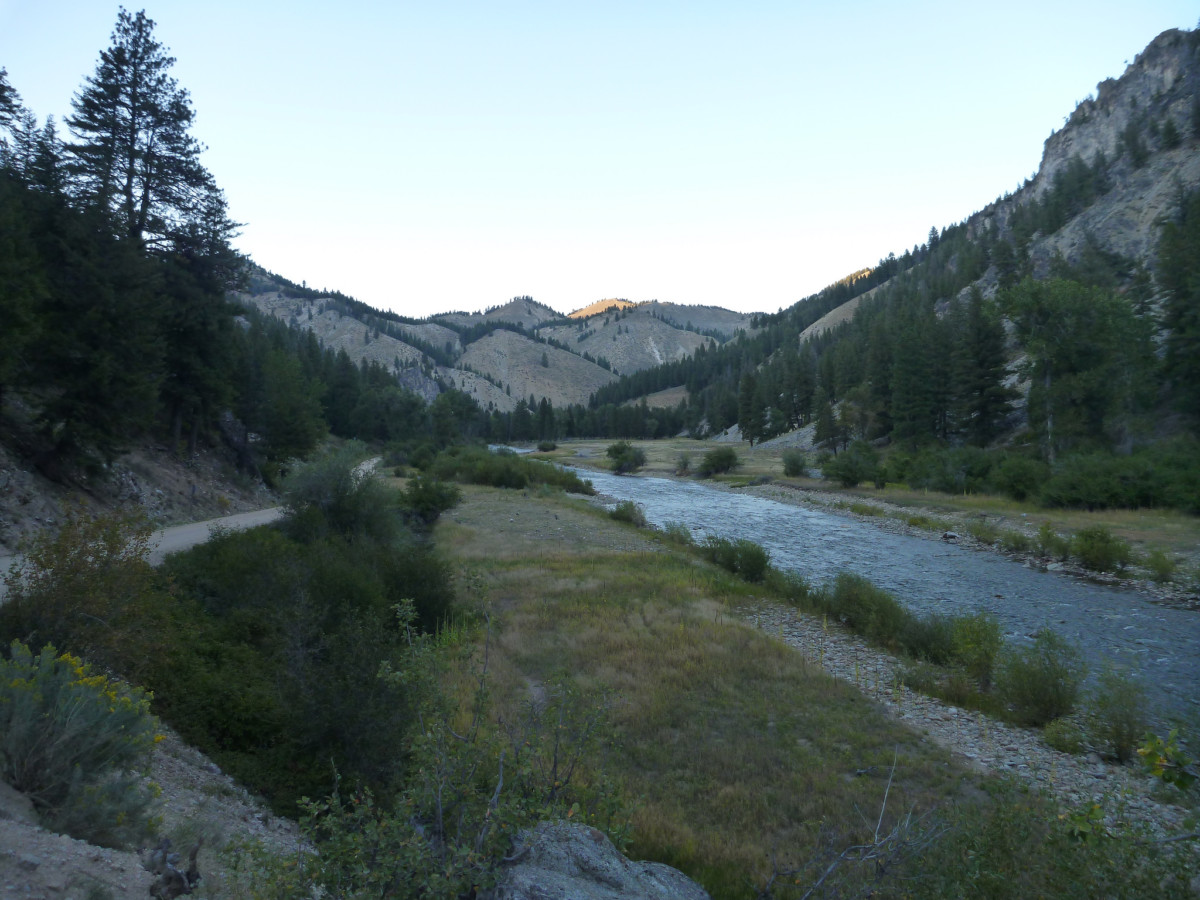
Many sections of the route are unmaintained and conditions are unpredictable.  After this past winter’s heavy snow and an unusually wet spring we expect even more ruts, loose rock, sandy washes, etc than in years past.  Keep your wits about you!  Much of the route is also very exposed to the sun, so protect yourself and be sure to start hydrated!  Here’s that route link again:  https://ridewithgps.com/routes/30292076
Bike/Tire Selection

Wide tires (2.2″/56mm or wider) and low gears are highly recommended.  Suspension won’t hurt (especially on the rough-and-tumble descent from the Eagleson Summit) but isn’t strictly necessary.  Any good mountain bike or dirt touring bike should be adequate.  Road, cyclocross or pavement touring bikes are not a good option.

Resupply Notes

There are no resupply options en route with the exception of the Ranch Market at mile 6.5.  Water may be filtered from Robie Creek between mile 30 and 33.  Be prepared to carry all food, water and supplies you will need to complete the route.

Questions?  Comments?  Call, email or stop by the shop.  Don’t forget to tag your photos:  #RidgeRoadRandonnee #RidgeRoadRandonneurs #BikeTouringNews.

Let’s Ride!

Categories
Other

Featherville Freakout!! Bike Travel Weekend 2019, May 31 – June 2

We’re really excited about this event and the chance to share the excitement and camaraderie of self-supported riding with friends!  In honor of this once-a-year event, Bike Touring News HQ will be CLOSED on Friday, May 31!

Watch this page for updates as the event approaches!  Questions?  Call, email or stop by the shop!

We hope you’ll join us for the 2019 Featherville Freakout, May 31 – June 2!  We want this to be an opportunity for riders of all ages and abilities to get out and sample a little slice of the spectacular riding here in Idaho, so rather than prescribing a route and setting the agenda we’re nailing down a meetup point and encouraging folks to plan their own adventures.  You can organize your own ride, invite your friends and tell us all about it at the campground on the South Fork of the Boise River!  We’d love to see riders from all across the state come together for a weekend gathering of the bike travel tribe!  Here’s how it’s gonna go down:

Our destination will be the Chapparal campground on the South Fork of the Boise – just upstream from the town of Featherville – for Friday and Saturday nights.  Nestled in the hills just south of the mighty Sawtooth Mountains, this stretch of road will be familiar to veterans of the Smoke ‘N’ Fire 400 or Idaho Hot Springs MTB Route.  There are ample opportunities for day riding, hiking, fishing, hot spring soaking, barstool rodeo, slingshot biathlon or any other outdoor games you want to play!

Route options to Chaparral could range from the seriously strenuous to super relaxed depending on your style and preference.  Make it as easy or challenging as you want!  No rules, no restrictions.  Just get your crew together, draw some lines on a map and come meet us riverside!

Want to host your own ride to the Featherville Freakout?  We hope you do!  Register your ride with the ACA so that other folks in your area can find it and join in!  You can also register as a private event if you’d rather pick and choose your riding companions.

Want to let someone else handle the route planning and join in a ride?  Check out the list below.  We’ll update this list with more rides as they are added.  Click the link to find more information and to register your participation.  You’ll get an sweepstakes entry for your trouble!  You can also contact the ride leader with any questions you might have.


Featherville Freakout Ride Listing (5/30/19 update)

Departing Boise on Friday – 87 miles, 7,400 ft climbing

Departing Boise on Friday, splitting the route into two days.

Departing Prairie on Saturday – 38 miles, 2,600 ft climbing

Departing Lowman on Friday – 73 miles, 8,640 ft climbing.  Cancelled due to excessive snow on route.


5/24/19:  Road Closure Update

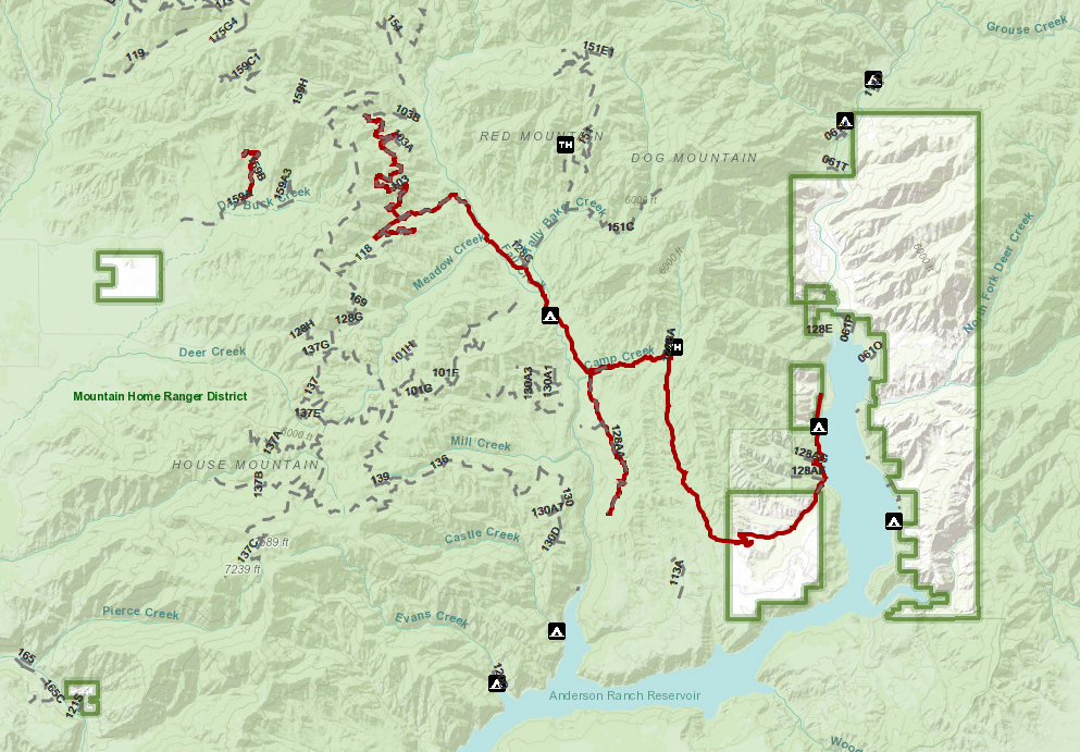
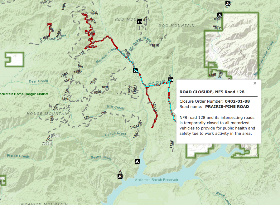
For those planning to connect through Prairie to Pine, be aware that a road closure is in effect on NF 128, the Prairie-Pine Road.  See the closure maps below.  You can find more information on the Boise NF’s alerts and closures page via this link.  Read the press release here.

The good news is that the closure is limited to motorized vehicles, so bicycles should be fine.  The closure may have also already been lifted.  The ranger on duty at the Mountain Home ranger district confirmed that the Prairie-Pine road is clear and gave the go-ahead for bike travel.  Be aware of forest management activity through this corridor and be safe!

Other Ride Options:

Ride from the Pine boat launch!  This is definitely the easiest option with around 15 miles and 800 feet of climbing on mostly-paved roads.  No significant climbs, just a gradual uphill at river grade.  This is a great option for folks on road touring bikes, new bike travelers or anyone looking for an easier, low-risk option.  Last year we had a handful of kids in trailers, on cargo bikes, etc riding from Pine, so this a great family-friendly option.

Ride from the Elk Creek boat launch!  This is probably the second-easiest option with 31 miles and 2,300 feet of climbing.  The start location doesn’t require a ton of drive time from the Treasure Valley, so this might be a good alternative for folks that want a little more of a ride but don’t want to drive to Prairie.  Much more dirt and some sustained climbing here, so consider this an intermediate level ride.


Friday Boise Departure Details:

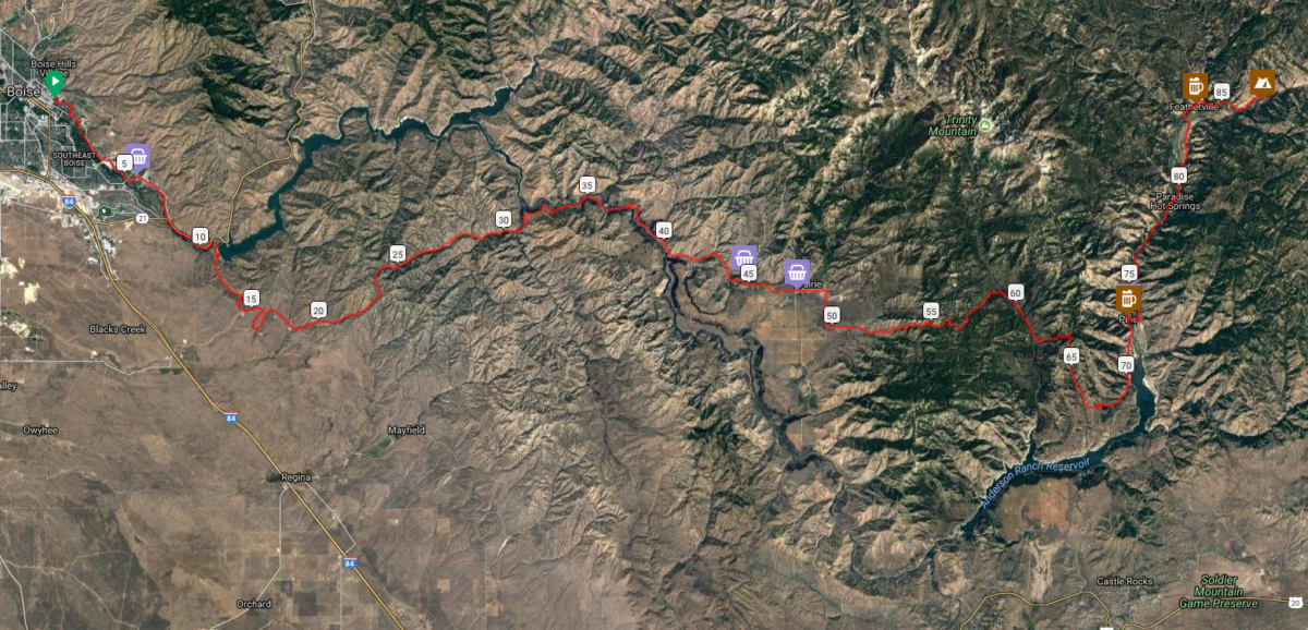
Want to ride from Boise on Friday?  A group will depart Fort Boise/Military Reserve Park (main parking lot between ballfields and Mtn Cove Rd) promptly at 9am and ride to Featherville via this route.   Here’s a brief description of the ride to whet your appetite!

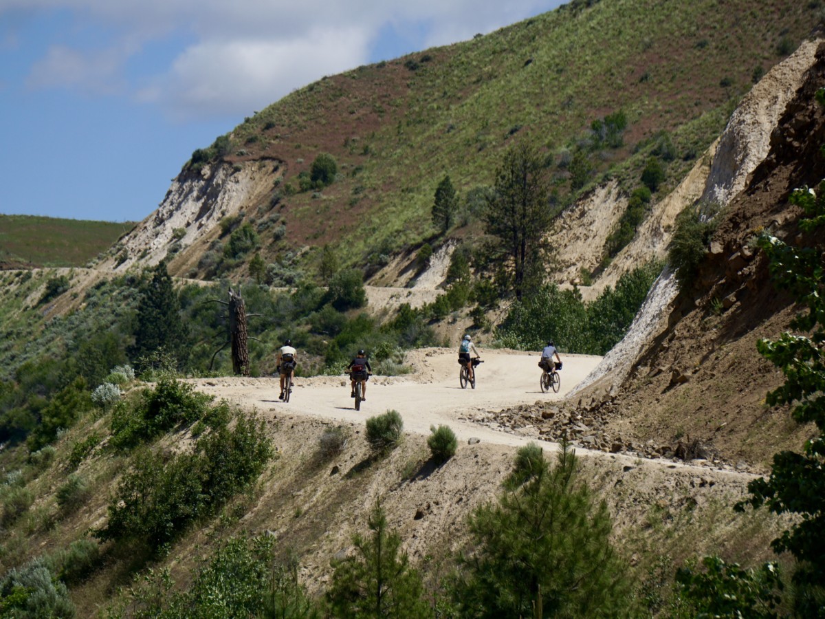
Terrain varies from a nasty hike-a-bike out of Lydle Gulch to smooth pavement near Pine.  Mostly, we’ll be on maintained dirt roads that will vary from smooth and hardpacked to loose, sandy, rocky and/or washboarded.  Any competent dirt touring bike with ~2″ tires will do fine.

This track (more or less) follows the route of the Smoke ‘N’ Fire 400, taking in a variety of southern Idaho landscapes and a moderate amount of climbing – for Idaho that is.  We’ll roll eastbound out of town through Lydle Gulch to Black’s Creek Road and follow the tailwater of the South Fork through some stunning scenery.

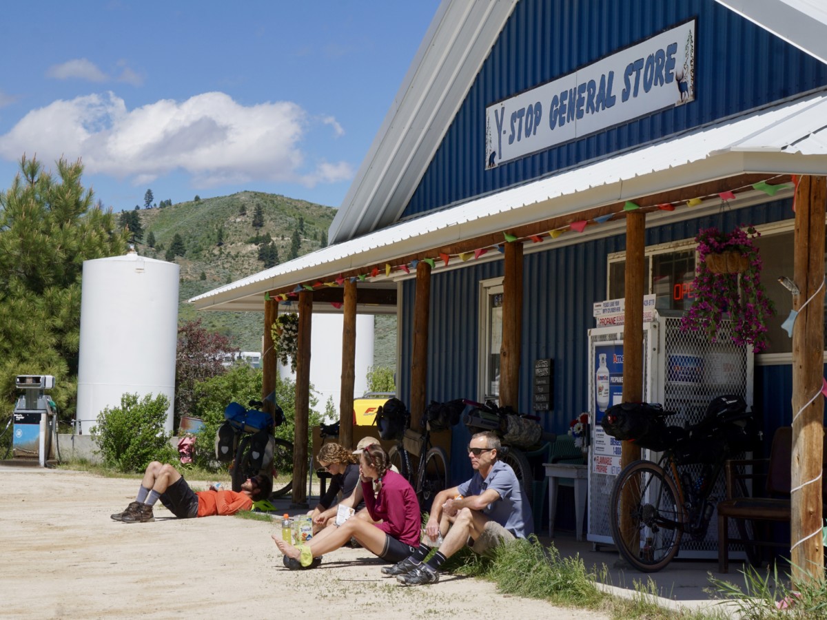
After climbing out of the South Fork, we’ll pass through the town of Prairie and take advantage of resupply options at the Y-Stop and Prairie Store.

We’ll cruise across the open plain before climbing into the hills south of the Trinity Mountains in the Boise National Forest.  Stretch your legs, take in plenty of sustenance and get ready to climb!

[NOTE: A portion of the route takes us through a forest service road closure.  See Road Closure Update above for more info.]

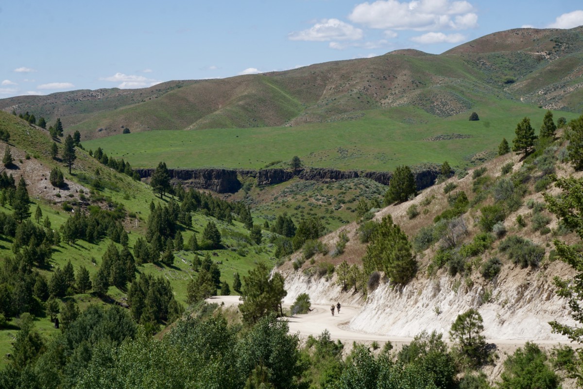
We’ll summit the high point of the ride right around 6,000 feet before descending to the Anderson Ranch Reservoir section of the South Fork.  The route turns back to the north and passes through the town of Pine.  Pine Cafe and Cocktails will tempt us with hot food and cold beverages while the Nitz Pine Store provides convenience store essentials.

Gracious curves heading down toward Pine

From Pine, we’re in the home stretch!  FR 114 will carry us along the east bank of the South Fork as we climb at a mellow river grade toward Featherville.  12 miles past Pine, we’ll have arrived!

We expect the 87-mile ride will require 7-8 hours of ride time, so a 9am departure should get us into the campground with plenty of time to make camp, prepare food and maybe even get some fishing in before dark.

Saturday will be a free day with ample opportunity for all kinds of outdoor recreation.  We’ll return to Boise on Sunday via the same route or a variation.  If you want to ride with us, don’t forget to register your participation here for an entry in the sweepstakes and to join the ranks of bike travelers across the world!

Regardless of your route choice, we hope you’ll join us and thousands of people across the world for the Featherville Freakout, part of Bike Travel Weekend 2018!  See you on the South Fork!

#rideloaded #feathervillefreakout #biketravelweekend #biketouringnews

Categories
Other

Montour Overnight – April Fool’s Errand

3/25/19 UPDATE:

This ride is only a few days away!  Looking forward to riding bikes and sleeping outside!  Here are a few key updates for those making the trip:

  1. WEATHER:  The forecast calls for a significant chance of rain all week leading up to departure.  Johnson Creek Road has the potential to get very muddy if it is saturated.  This portion of the route should be avoided if significant wet conditions are present.  The heavy clay mud will foul all manner of moving parts and could create a dangerous situation.  Most of the other dirt roads will be fine with some added moisture – they’re well-graveled with porous material, drain well and shouldn’t get muddy.  Here’s a link to an alternate version of the route that avoids Johnson Creek:  https://ridewithgps.com/routes/29560824   This option adds around 10 additional miles and a couple of mid-size climbs, so be sure to allow extra time for your trip over the hill if we have a rainy week.  The wet weather is forecast to move out late in the week (sunny and 60 on Saturday!) but it wouldn’t be a bad idea to pack a tarp if you have one to help create some sheltered space for cooking and hanging out in camp.
  2. CAMPING:  The folks at the Bureau of Reclamation gave us the all-clear to camp at Montour but there are a couple of things to keep in mind if we want to be welcomed in the future.  Please be respectful of nearby residents and KEEP NOISE LEVELS DOWN in the campground, especially in the evening.  There are other places to go if you want to get rowdy.  The land managers typically send groups (Boy Scout troops, etc.) elsewhere when Montour is closed to provide peace and quiet for the folks who live adjacent to the campground.  Also, let’s leave the place cleaner than we found it.  Be prepared to spend a few minutes picking up trash, sticks, or other debris.  There is a dumpster on site to deposit refuse.  Leave No Trace, y’all!


3/7/19

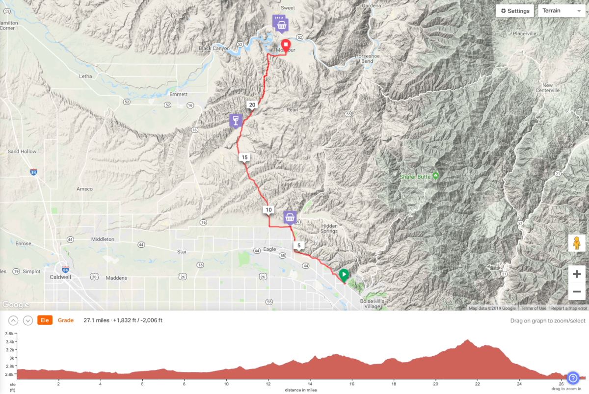
Spring is nigh here in the City of Trees!  Time to head for the hills on our first o’nighter of the year – March 29-31st!  Join us for a challenging climb out of the Treasure Valley on a mix of pavement and dirt followed by an unmaintained dirt road descent to the banks of the Payette.  Nestled in the Sweet Valley, the Montour WMA campground will be our destination.  This is one of our favorite overnight trips from town and has become something of a springtime tradition.  The route is great for new bike travelers but still offers enough of a challenge to keep the experienced on their toes.  Longer route options also abound for those looking for more miles.  All people and bikes are welcome!  However, some people and bikes will have more fun than others!

Starting down Johnson Creek Rd, May 2017.

Bike Selection

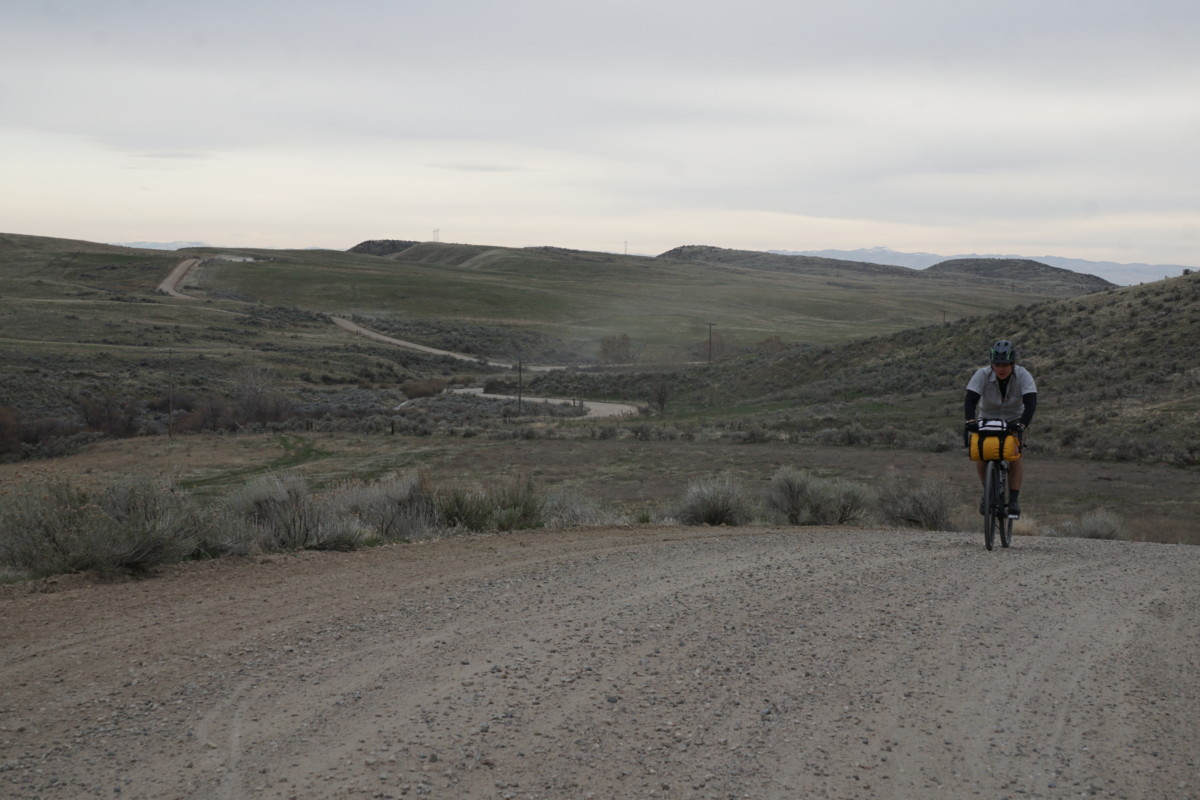
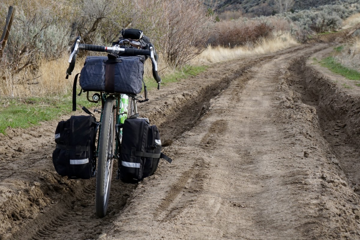
Any sturdy bikepacking/dirt touring bike will handle the terrain just fine.  Wider tires and low gears are highly recommended.  Plus-tired rigs or suspended MTBs will be overkill for much of the route but will certainly make the descent more fun!  Allroad or cyclocross bikes (similar to Zach’s ride in the below photo) will also get you by if you pack light.  Variable road conditions can make life difficult if you’re under-tired, overgeared and overloaded.  The climbs over the Eagle foothills are steep in spots and the Johnson Creek descent can be pretty dodgy with deep ruts and stream overflow (see photos) but this is definitely one of the easier, more accessible overnight trips from Boise.  Just enough challenge to be satisfying!  Distance from downtown/north Boise will be around 30 miles and less than 2,000ft of climbing via our route3/25/19 UPDATE:  See WEATHER notes above!

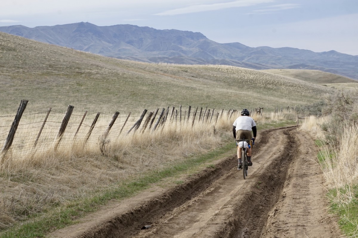
Riding the Eagle foothills rollers, March 2018

Take Note!  This is not a bike event!  This is a self-supported, weekend bike ride with a group of friends.  We are offering a route suggestion, some potentially useful (or potentially inaccurate) information and nothing more.  All riders are responsible for their own safety and enjoyment, should come prepared to be 100% self-sufficient and have their own self-rescue or bailout plans in place.  Do not count on cell phone service.  That said, riding bikes is fun, overnight rides are even more fun and both are best when shared.  We welcome any and all riders who want to join in for any portion of the weekend’s journey!

Rides will depart from Bike Touring News HQ at:


Departure Notes

No need to register, sign up or RSVP.  Just show up ready to ride!  Times above are departure times, so please arrive a few minutes early if you need to make final preparations before rolling out.  The shop will close at 4pm for Friday’s departure, so we will not be available for last minute purchases on Saturday.  Plan ahead and prepare!

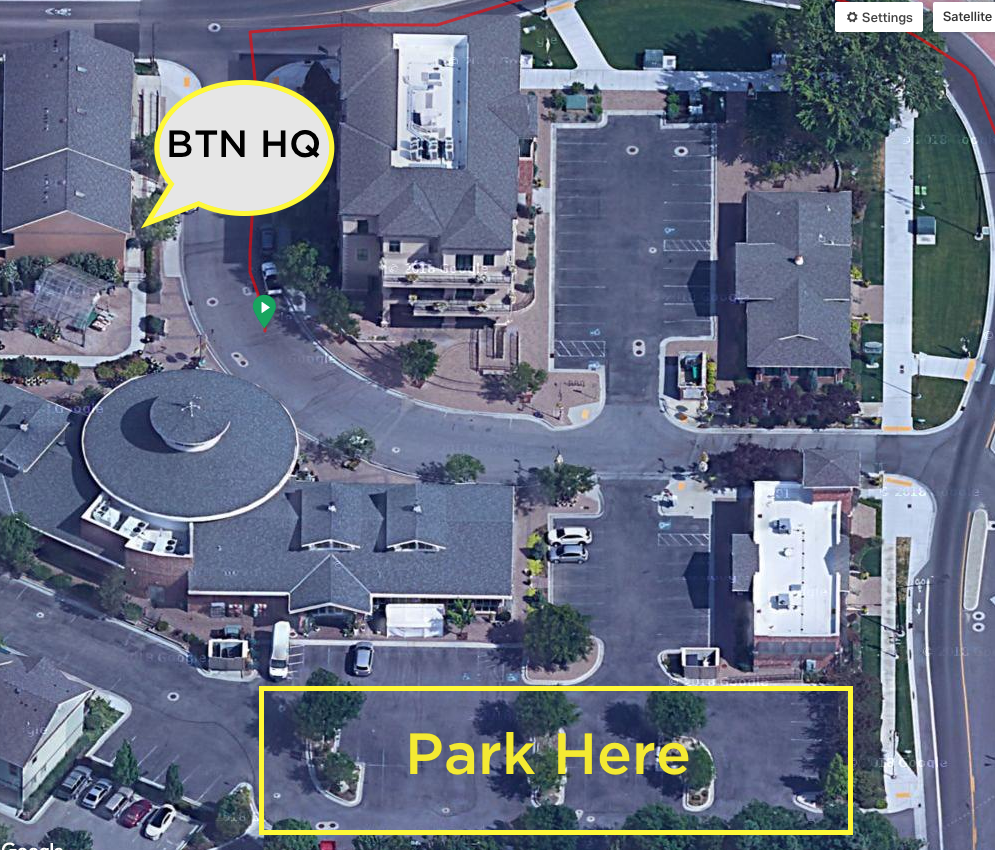
If you’re planning to leave a vehicle overnight, please park in the main parking lot off 36th Street rather than the parallel parking spaces along Garden Center Way.  Better yet, ride your bike to the start!  See parking lot map below:

Camping

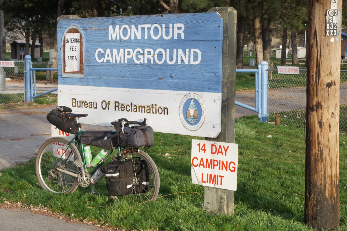
The Montour campground will still be closed for the season but toilets have been open and water flowing in springs past.  No promises!  If the campground is open, the fee for tent camping in the grassy area at back (east) of the campground is $3/night.  If the campground is closed there is no required payment but we like to try and leave a few bucks in the pay slot to (hopefully) help maintain this little gem of a campground.  We’ll also do a little cleanup and leave the place cleaner than we found it.  3/25/19 UPDATE: See CAMPING notes up top!

Services

With the exception of the Chevron at the corner of Beacon Light and Hwy 55, there are no services on the route.  Bring plenty of water to get you through the exposed, shadeless roads over the Eagle foothills, especially if the sun is bright and temperatures high.  Johnson Creek will be a (mostly) reliable water source for filtering but at that point you’re nearly to the campground.

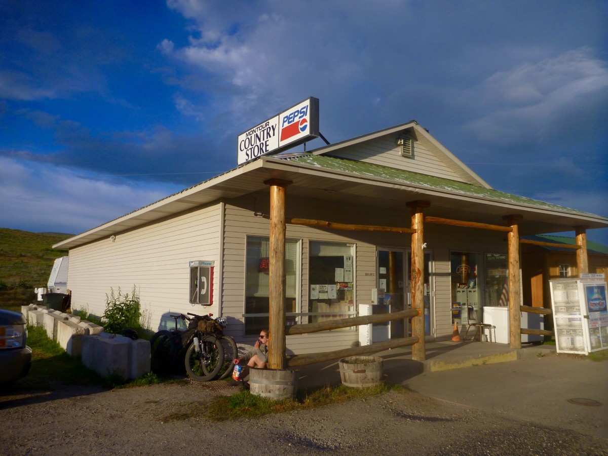
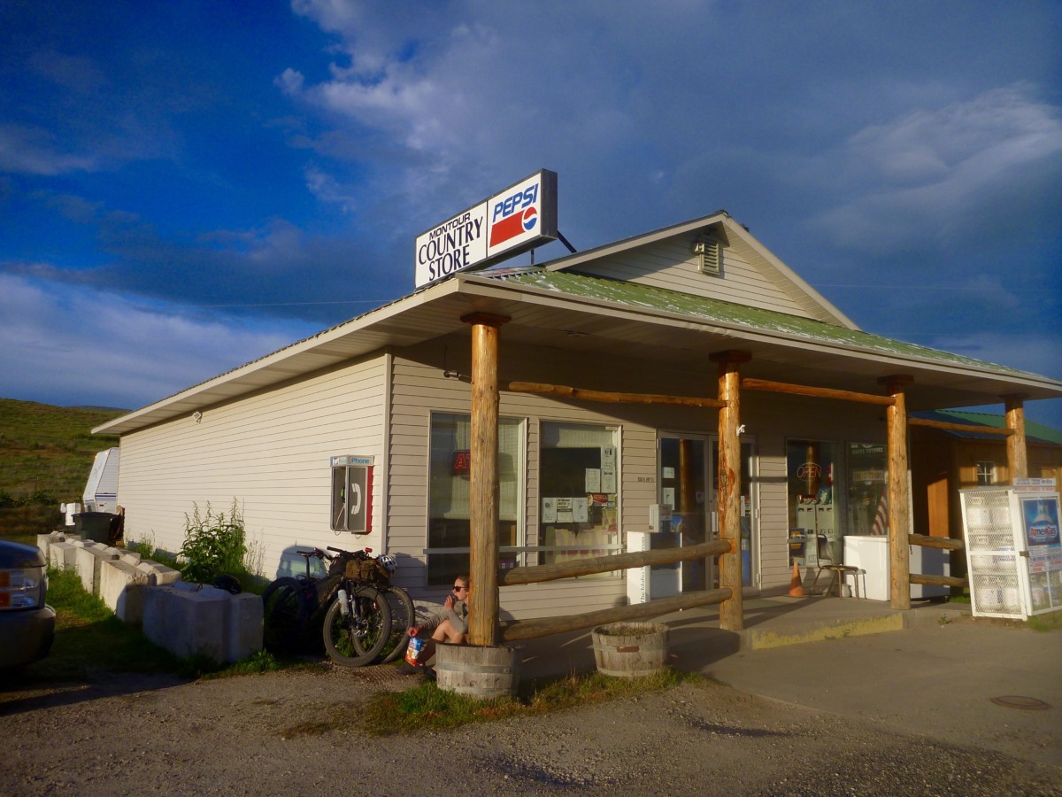
After arriving at Montour, you’ve got a handful of options for food and beverages.  The Montour Country Store is about 2.5 miles northbound with snacks, beverages and other convenience store goods.  The Triangle Restaurant and bar is equidistant, serving up a diverse menu with a small bar to wet your whistle.  The Ola Inn Cafe lies 19 miles north via the nicely paved and rolling highway.  Horseshoe Bend to the east and Emmett to the west each have a range of stores, restaurants, etc.  Hours may vary at each of these locations, so do your homework if you’re relying heavily on any of these services.  There are plenty more paved and unpaved roads to explore in the Sweet/Ola Valley, so folks looking for a longer ride or more miles can have their fill.

Route Notes

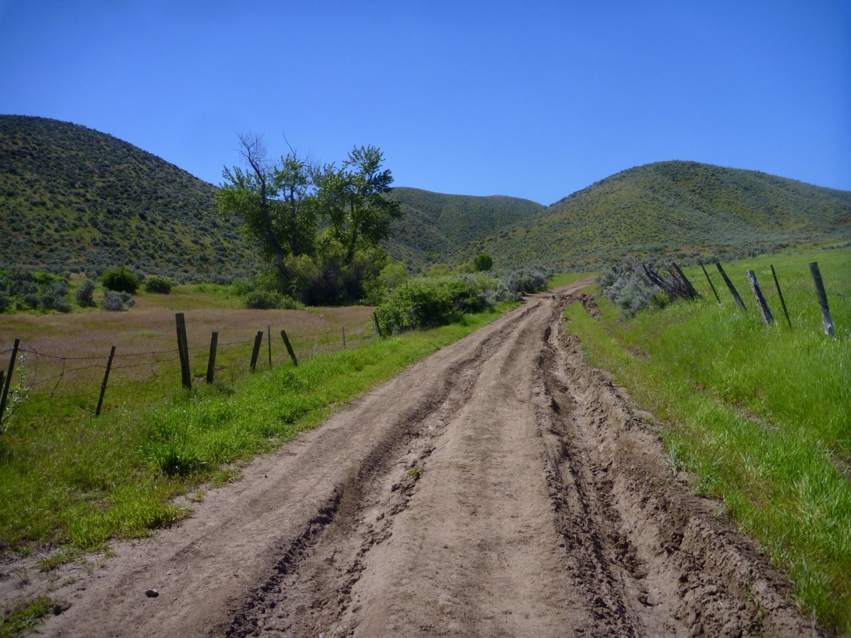
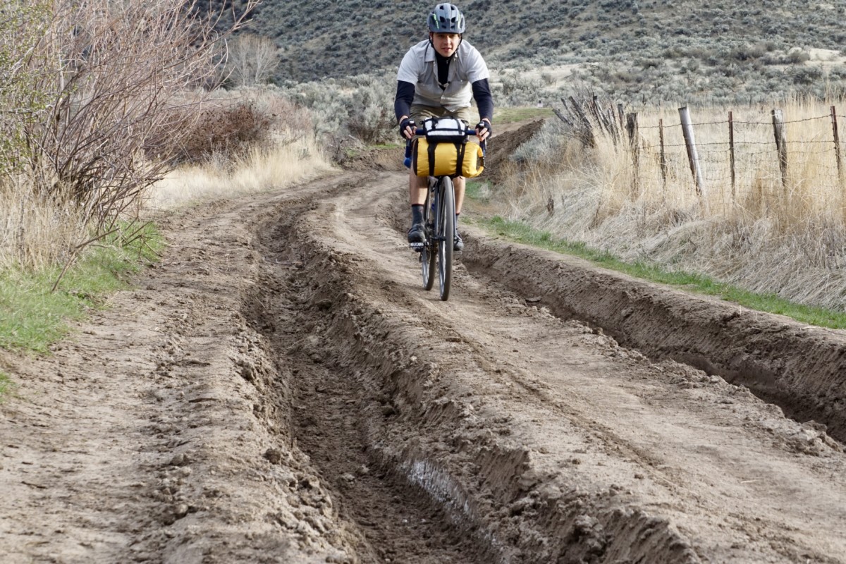
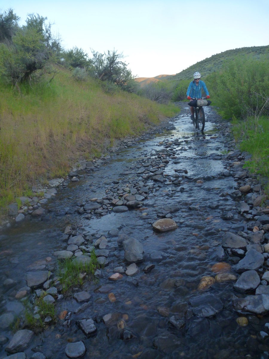
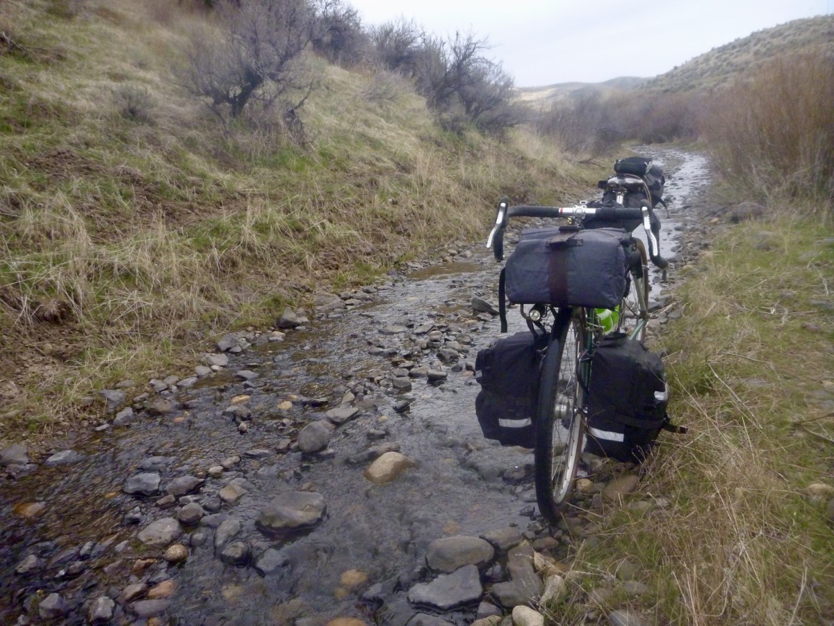
The descent down the Johnson Creek road hasn’t received any maintenance (that we know of) at least since 2017, maybe longer.  It is likely to be in poor shape and may not be 100% rideable.  Muddy conditions may require a reroute but we expect mostly dry conditions.  3/25/19 UPDATE:  See WEATHER notes up top!  Ruts will likely be quite deep with rideable lines in between.  Use caution and don’t risk a nasty crash!  There is one extended section where the creek has overflowed the road.  This mile-ish stretch will likely be running with at least a couple inches of water and is paved with round, loose babyhead rocks.  Be prepared to walk/carry your bike if the going gets rough along this streambed section.  See photos and captions below for illustration of the conditions.

Johnson Creek Rd, May 2017.


Same stretch of road, March 2018.


Choose your line wisely and watch your speed!


Creek bed riding, May 2017.

We’re looking forward to this first overnighter of the season and many more to come in 2019!  Questions?  Concerns?  Stop by the shop, call or email.  Can’t wait to see who shows up to camp!

208-806-2111  |   [email protected]

@biketouringnews  |  #bikeovernights  #rideloaded  #aprilfoolserrand

Categories
Other

Harriman Trail Bikefishing Meetup – Saturday, September 29 – Bike Your Park Day 2018

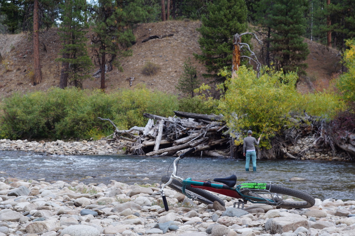
Fall has arrived in Idaho and this is arguably the best time of year for fishing by bike!  In addition, Saturday, September 29 is the Adventure Cycling Association’s Bike Your Park Day, an annual celebration of our public lands.  Let’s enjoy one special slice of Idaho’s wealth of public land with a day of fishing by bike along the Big Wood River!

No registration, fee or RSVP is required. All ages, abilities, fishing styles and bike types are welcome.  Just load up your rig with your fishing gear and let’s go in search of trout!

The Plan

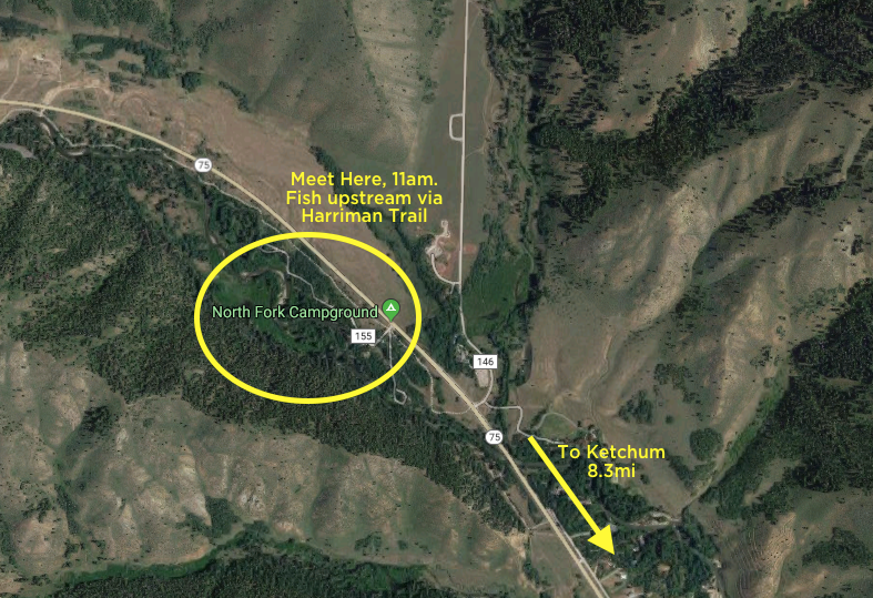
We’ll meet at the North Fork Campground trailhead (southeast end of the Harriman Trail) at 11am on Saturday, September 29.  From there we’ll pedal upstream, probing the waters at fishy-looking spots along the Big Wood River and (potentially) its tributaries.  The warmest part of the day is likely to deliver the most productive (and most comfortable) fishing, so we’ll try our luck and test our skills until late afternoon before pedaling back to the trailhead.

All ages, abilities, bikes and tackle are welcome!  Invite your friends, RSVP or plan rides via the Facebook Event Page: https://www.facebook.com/events/2147476645473230/

To sweeten the deal, the Adventure Cycling Association is giving away a Co-Motion Cycles Divide touring bike and two Amtrak tickets to Glacier National Park, so register your participation via this link for a chance to win!

What to Bring

  • Bike – The Harriman Trail is (mostly) a well-maintained gravel two-track with moderate grades.  Any mountain bike or dirt touring bike will do fine.
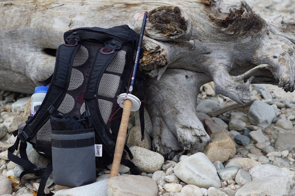
  • Fishing Gear – All legal tackle and techniques are welcome.  We’ll have tenkara outfits from Tenkara USA and DRAGONtail Tenkara available for folks to try out this simple method of fly fishing.
  • Idaho Fishing License – Available from local outfitters or online at https://idfg.idaho.gov/
  • Appropriate Clothing/Wading Gear – Be sure to bring a dry change of clothes, especially if you plan on wading.  Hypothermia happens fast in cold water!  Temperatures are highly variable and will swing widely throughout the day, so dress in layers and be prepared for anything.  Rain is not highly likely but is always a possibility.  See NOAA’s forecast page for weather updates.
  • Food and/or Beverages – Don’t forget to pack any snacks or drinks you’ll need to stay fueled and hydrated throughout the day.


Questions?  Concerns?  Call the shop (208-806-2111), send us an email ([email protected]) or stop by any time!  Like our Facebook page and follow @biketouringnews on Instagram for updates.

Hope to see you out on the Big Wood for a great day of fishing by bike!

#bikeyourparkday #fishbybike #rideloaded #biketouringnews


Categories
Idaho Our Trips

Bike Travel Weekend: Featherville Freakout, June 1-3

5/25/18 UPDATE:  We’ve got some AMAZING PRIZES from Tenkara USA, DRAGONtail Tenkara, Sinewave Cycles, Revelate Designs, Surly, WTB, Quality Bicycle Products and the Adventure Cycling Association to give away!  You could be a winner!  All you need to do is follow our social media channels (Facebook, Instagram, Twitter), sign up for our email mailing list and keep an eye out for instructions in GIVEAWAY posts!  You don’t have to attend the Featherville Freakout or participate in Bike Travel Weekend to win but it will definitely help your chances!

We’ve also added a handful of new hosted rides to the Featherville Freakout!  There are options for all ages and abilities!  Scroll down for the most current list.  Don’t see a ride that suits you and your crew?  Host your own!

}}}—————————————–>

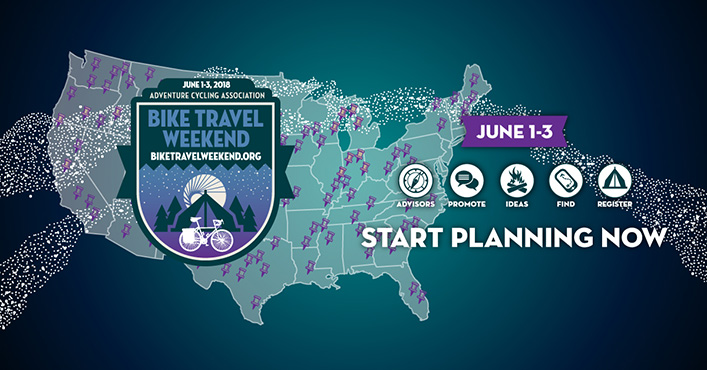
Bike Travel Weekend 2018 is the first weekend in June and coming up fast!  This will be the third year that the Adventure Cycling Association has organized this worldwide event, so what better opportunity to strike out on your first overnight trip or help get your friends hooked on bike travel!

We’re really excited about this event and the chance to share the excitement and camaraderie of self-supported riding with friends!  In honor of this once-a-year event, Bike Touring News HQ will be CLOSED on Friday, June 1!

We hope you’ll join us for the very first Featherville Freakout, June 1-3!  We want this to be an opportunity for riders of all ages and abilities to get out and sample a little slice of the spectacular riding here in Idaho, so rather than prescribing a route and setting the agenda we’re nailing down a meetup point and encouraging folks to plan their own adventures.  You can organize your own ride, invite your friends and tell us all about it around the campfire on the South Fork of the Boise River!  We’d love to see riders from all across the state come together for a weekend gathering of the bike travel tribe!  Here’s how it’s gonna go down:

Chapparal CG, back in July 2014

Our destination will be the Chapparal campground on the South Fork of the Boise – just upstream from the town of Featherville – for Friday and Saturday nights.  Nestled in the hills just south of the mighty Sawtooth Mountains, this stretch of road will be familiar to veterans of the Smoke ‘N’ Fire 400 or Idaho Hot Springs MTB Route.  There are ample opportunities for day riding, hiking, fishing, hot spring soaking, barstool rodeo, slingshot biathlon or any other outdoor games you want to play!

Route options to Chaparral could range from the seriously strenuous to super relaxed depending on your style and preference.  Make it as easy or challenging as you want!  No rules, no restrictions.  Just get your crew together, draw some lines on a map and come meet us riverside!

If you want to host your own ride to the Featherville Freakout (and we hope you do), register it with the ACA so that other folks in your area can find it and join in!  You can also register as a private event if you’d rather pick and choose your riding companions.  By registering, you’ll also enter to win a Co-Motion Divide bicycle and Amtrak tickets to Glacier National Park!

Want to let someone else handle the route planning and join in a ride?  Check out the list below.  Click the link to find more information and to register your participation.  You’ll get an sweepstakes entry for your trouble!  You can also contact the ride leader with any questions you might have.


CURRENT RIDE LISTING (updated 5/25/18)


Want to ride from Boise on Friday?  A group will depart Fort Boise/Military Reserve Park (main parking lot between ballfields and Mtn Cove Rd) promptly at 9am and ride to Featherville via this route.   Register your participation here for an entry in the sweepstakes and to add your name to the list of participants across the world.  Here’s a brief description of the ride to whet your appetite!

Terrain on the route varies from a nasty hike-a-bike out of Lydle Gulch to smooth pavement near Pine.  Mostly, we’ll be on maintained dirt roads that will vary from smooth and hardpacked to loose, sandy, rocky and/or washboarded.  Any competent dirt touring bike with ~2″ tires will do fine.

This track (more or less) follows the route of the Smoke ‘N’ Fire 400, taking in a variety of southern Idaho landscapes and a moderate amount of climbing – for Idaho that is.  We’ll roll eastbound out of town through Lydle Gulch to Black’s Creek Road and follow the tailwater of the South Fork through some stunning scenery.

After climbing out of the South Fork, we’ll pass through the town of Prairie and take advantage of resupply options at the Y-Stop and Prairie Store.

We’ll cruise across the open plain before climbing into the hills south of the Trinity Mountains in the Boise National Forest.  Stretch your legs, take in plenty of sustenance and get ready to climb!

We’ll summit the high point of the ride right around 6,000 feet before descending to the Anderson Ranch Reservoir section of the South Fork.  The route turns back to the north and passes through the town of Pine.  Pine Cafe and Cocktails will tempt us with hot food and cold beverages while the Nitz Pine Store provides convenience store essentials.

Gracious curves heading down toward Pine

From Pine, we’re in the home stretch!  FR 114 will carry us along the east bank of the South Fork as we climb at a mellow river grade toward Featherville.  12 miles past Pine, we’ll have arrived!

We expect the 87-mile ride will require 7-8 hours of ride time, so a 9am departure should get us into the campground with plenty of time to make camp, prepare food and maybe even get some fishing in before dark.

Saturday will be a free day with ample opportunity for all kinds of outdoor recreation.  We’ll return to Boise on Sunday via the same route or a variation.  If you want to ride with us, don’t forget to register your participation here for an entry in the sweepstakes and to join the ranks of bike travelers across the world!

Regardless of your route choice, we hope you’ll join us and thousands of people across the world for the Featherville Freakout, part of Bike Travel Weekend 2018!  See you on the South Fork!

#rideloaded #feathervillefreakout #biketravelweekend #biketouringnews

Categories
Bike Touring Equipment Surly Bikes Touring Bicycles

FLASH SALE! Surly Floor Models for Killer Deals + Special Saturday Hours

Bike Touring News FLASH SALE!

Thursday, April 19  –  Friday, April 27

Special Saturday Hours:  11am – 5pm, Saturday Apr. 21 

Select Surly Floor Models 10-20% Off!

Killer Deals on Closeout/Overstock Gear, Parts and Accessories

See Spring Cleaning Sale category on the web store to check out the deals!

Local Folks!  Order online and pick up in-store to avoid paying for shipping!

SALE Bikes Include:

ECR, Large, “Beige Pantsuit”

Ogre, Medium, “Rover Brown”

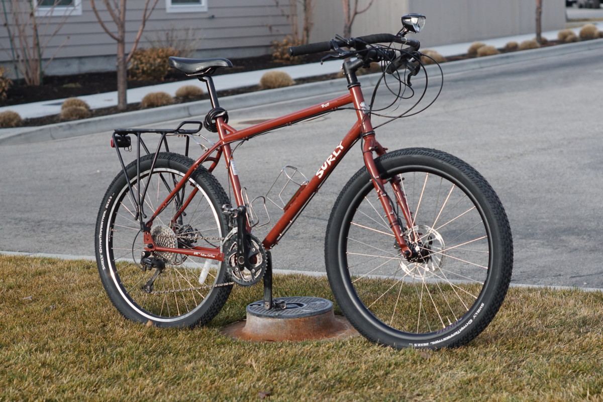
Troll, Large, “Get Gone Maroon”

Last of this color option! “Pea Lime Pie Soup” is the new color.

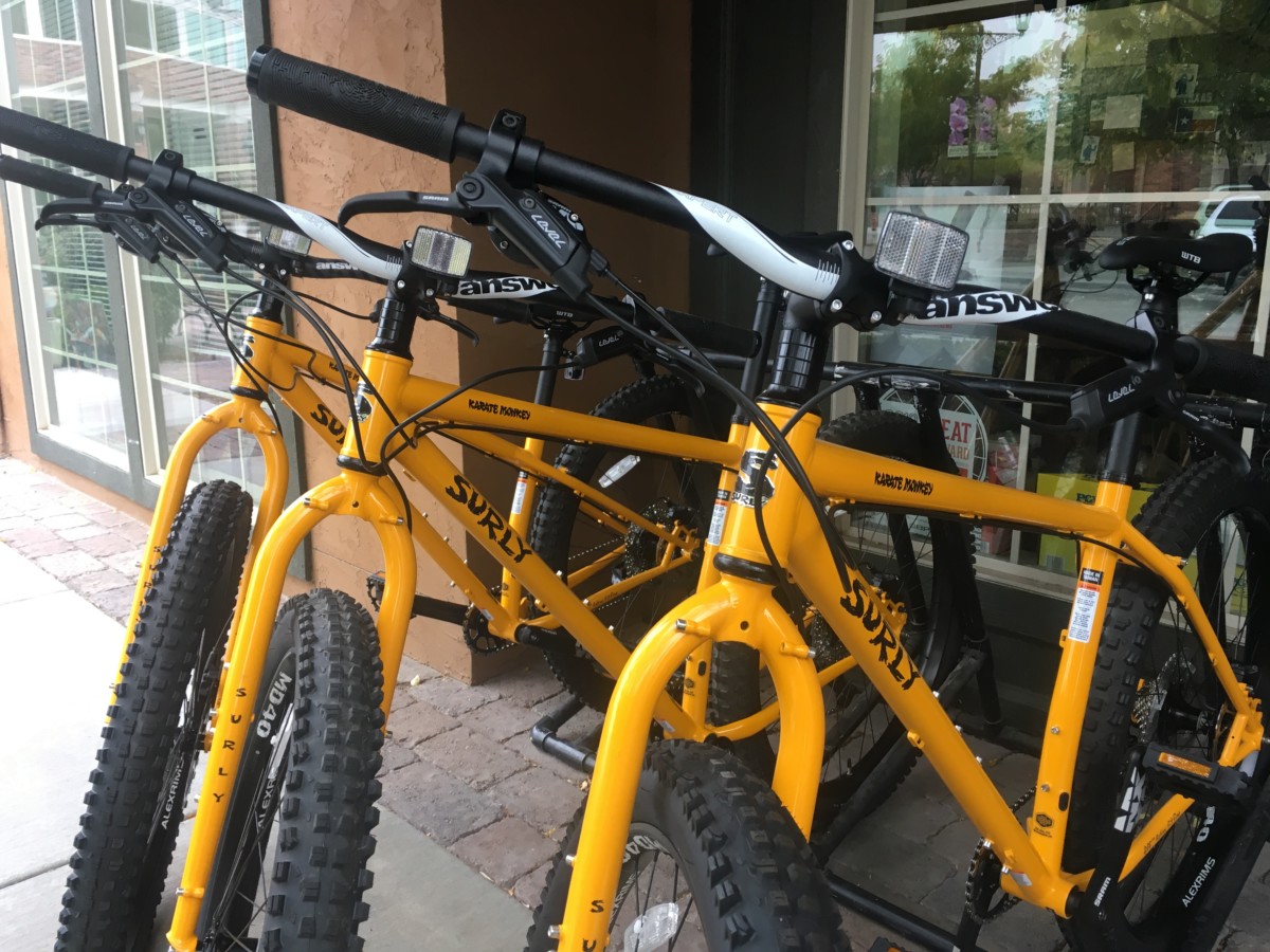
Karate Monkey, Large (sold) and Small, “Rhymes with Orange”

Last of this color option!  “Hi-Viz Black” is the new color.  Price has gone up also.

Bikes must be picked up in store!  Sorry, no remote sales.

As always, we offer 10% off and free installation of nearly any upgrade or addition you want to make to your new bike!

Let’s get you dialed in on a bike that will really take you places!

Categories
Idaho Our Trips Planning Resources Surly Bikes Touring Bike Tires

Testing the Pack Rat and Road Plus Tires on an April Fool’s Errand

Back in December 2017, Surly announced the release of a new front-loading light touring bike – the Pack Rat.  I was excited about the possibilities from the moment I learned of this bike’s existence and Bike Touring News was one of the first shops to stock them.  In the intervening 4 months, Surly has released no fewer than three more new models – the “Allroad” Midnight Special, a redesign of the Pugsley expedition fatbike and the entry-level dirt touring Bridge Club.

What with all this newness in such a short period, I was a little afraid that the humble Pack Rat might be forgotten.  I had already had favorable impressions from brief rides around town, so I set out to test this bike’s capabilities on a weekend ride.  I wanted to know if the Pack Rat was capable of loaded touring over the mix of terrain we commonly encounter here in Idaho and if this was a platform I could recommend for two-wheeled exploration past the end of the pavement.

In order for this road test to be meaningful, I’m going to need you to hang with me in the Land of Make-Believe for just a little while.  Got your Imagination Cap on?  Good.

I’m going to make a statement that should be treated as fact for the duration of this post.  Ready?

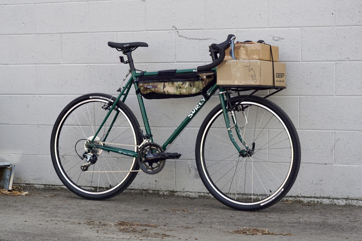
The bike pictured below is a Pack Rat.  Got it?

My old war horse of a touring bike – affectionately known as the Rando-Gnar – is nearly identical to the Pack Rat in every way that matters.  Both bikes are designed around 650b wheels with clearance for 47mm “Road Plus” tires.  Both feature geometry optimized for a front load.  Steel frames, drop bars, cantilever brakes, plenty of braze-ons for racks and cages.  Heck, they’re even (almost) the same color.  Nearly every component on the Rando-Gnar would move right over onto a Pack Rat frame.

In order to transform a stock Pack Rat into the bike you see above, all you need to do is mount a set of WTB Byway tires, drop the gearing down a bit and attach whatever racks and bags you deem necessary.  Boom, pow!  You’re ready to pack your gear and hit the road.

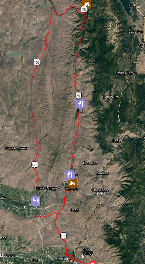
For this exploration of the Pack Rat’s touring capabilities, I mapped out a route that would cover around 160 miles of paved and dirt roads that would vary widely in condition.  I knew of one stretch of unmaintained road that would likely be in very poor condition.  The roads that climbed into the foothills of the Boise and Payette National Forests were more of an unknown quantity as I had not ridden them before.  I had some idea of what to expect and had been assured by a Forest Service Ranger that the roads were free of snow – though I had my doubts.  Most of the remainder consisted of varying qualities of pavement and maintained dirt roads.

I set out from Boise on smooth pavement and re-adjusted to the ride of a loaded bike.  My haphazard packing strategy resulted in a heavier bike than I would have liked but I felt confident that I was well prepared for the unpredictable springtime weather and road conditions.  Rolling tubeless at 42psi, the Byways cruised down the pavement nearly as fast as a good racing tire.  I felt the weight of my load when the road turned uphill but the ride was speedy and efficient overall.

When the road turned to dirt in the rolling foothills north of Eagle, the Pack Rat pressed ahead with aplomb.  Traction was adequate for out-of-the-saddle riding over some of the steeper pitches, though I had to be conscious of my weight distribution to prevent the rear tire from slipping on looser ground.

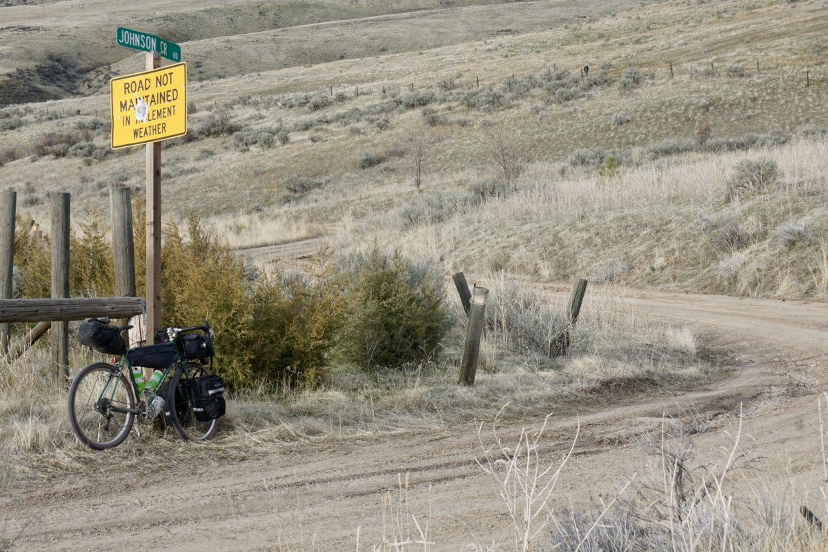
From the saddle at the top of Sand Hollow Road, our route descended the unmaintained Johnson Creek Road to the Payette River.  This road bears deep, rutted scars from heavy truck use in wet conditions and is very eroded in spots.  We rolled in, enjoying the views while keeping to the high ground between the ruts.

The ruts were nearly three feet deep in spots but the clay was hard and firmly packed, making for predictable traction even at off-camber angles.

One section of the road has been completely taken over by the creek and presents about a quarter-mile of bumpy riding over loose, slippery river rocks.  I rode cautiously but never felt in danger of bottoming out my tires.

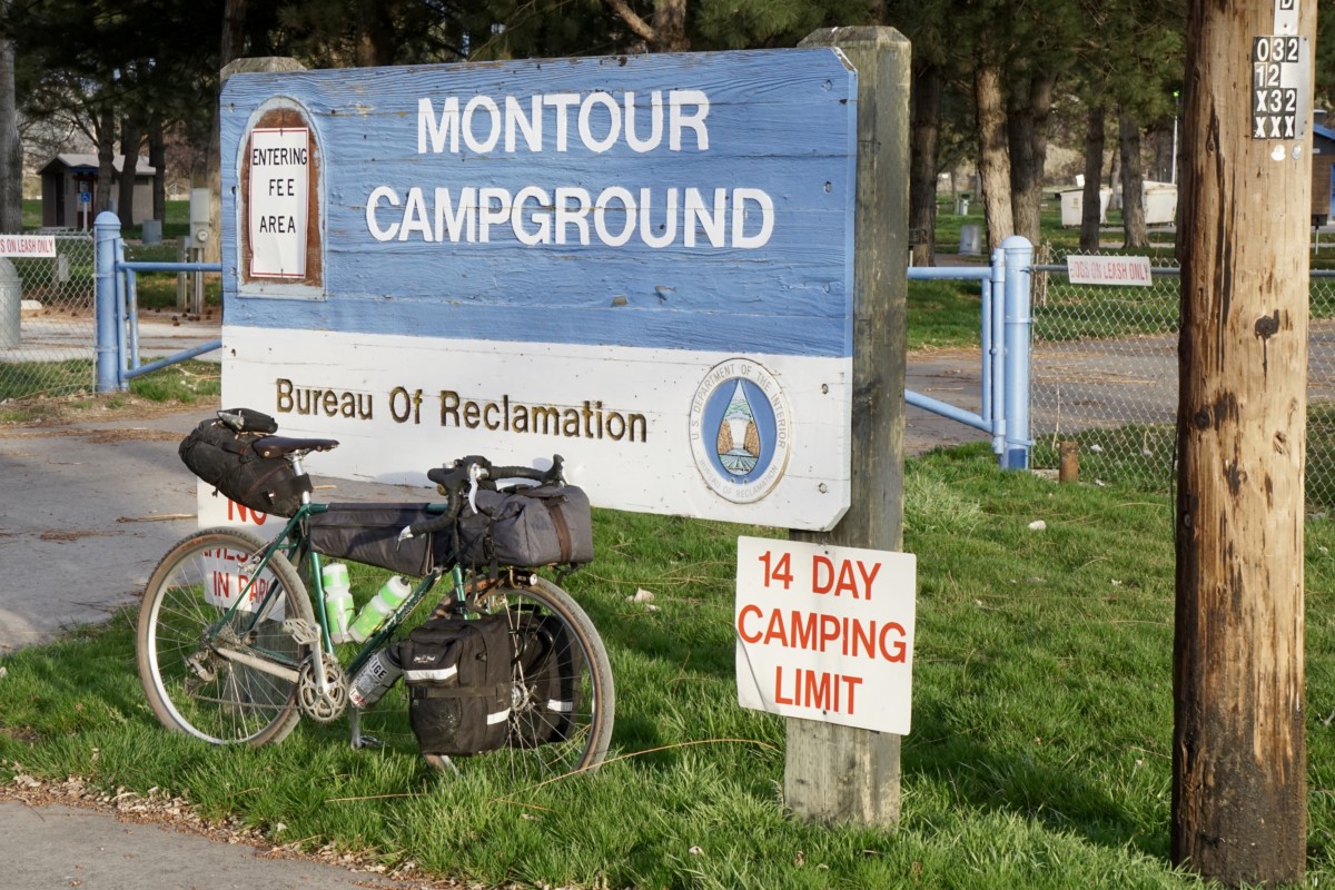
Johnson Creek Road drops into Shalerock Road, a wide and well-maintained dirt road that descends into the Montour Valley.  We basked in the dusky light on the descent to the Montour Campground for the first night’s camp.

After a hearty breakfast at the Triangle Cafe we struck out to the north the next morning, gradually gaining elevation on the paved Sweet/Ola highway.  The snowy mountaintops in the distance made me wonder about the elevation of the snow line.

The road turns to dirt a couple of miles past the little town of Ola.  Conditions were excellent – nicely packed clay with a scattering of loose pea to marble-sized gravel.  The Pack Rat carried speed well and cornered confidently.

I was forced to adapt my pedaling rhythm to the lumpy terrain and the Pack Rat responded well – forging forward to crest each roller as I rose out of the saddle.

The Byway tires provided a sufficiently large contact patch and plenty of cushioning to keep the bike composed on the quick descents.  Momentum is everything when pedaling a loaded bike, so it was nice to have the confidence to let the bike run on the short downhills and carry good speed into the next climb.

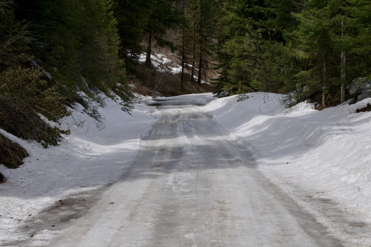
The road continued to wind its way north, following Squaw Creek toward its headwaters in the Payette National Forest.  We were getting close to 4,000 feet above sea level and entering the pine forest, so we began to encounter wet conditions and sections of slushy snow on the road.

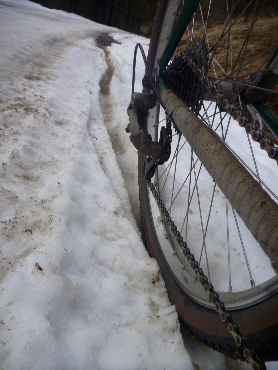
The 47mm tires sank somewhat into the softened road surface, slowing their roll and forcing me to work harder for the same speed.  However, they certainly provided more traction and flotation than narrower tires would have.

The road began to climb more steeply and the snowy stretches became longer until they became practically uninterrupted.

While the snow was not very deep, the Byway’s diamond tread didn’t provide enough bite for steering or pedaling through the slippery slush.  Likewise, the 47mm width was not sufficient to say on top of the crust layer.  I could ride brief stretches when the road leveled out but climbing was not possible.

When I was able to ride, I was constantly attempting to correct my line and keep the bike from sliding out from under me.  A mountain bike with 2-3″ tires would have handled these conditions much better than the Pack Rat but would have also been sluggish on the pavement and smooth dirt roads.

We pressed on despite the snow-covered road.  Traction was sufficient for walking and I didn’t think the pass was all that distant.  In hindsight, I probably should have paid attention to the omens and turned back.

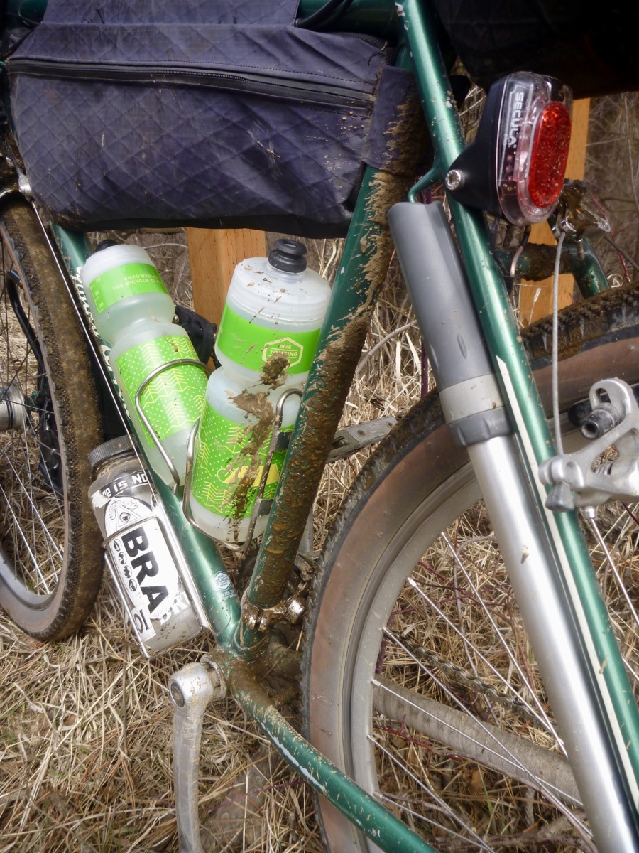
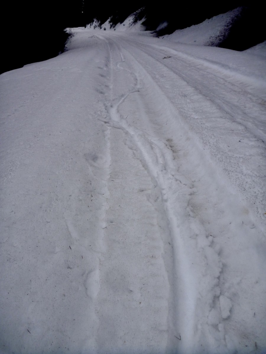
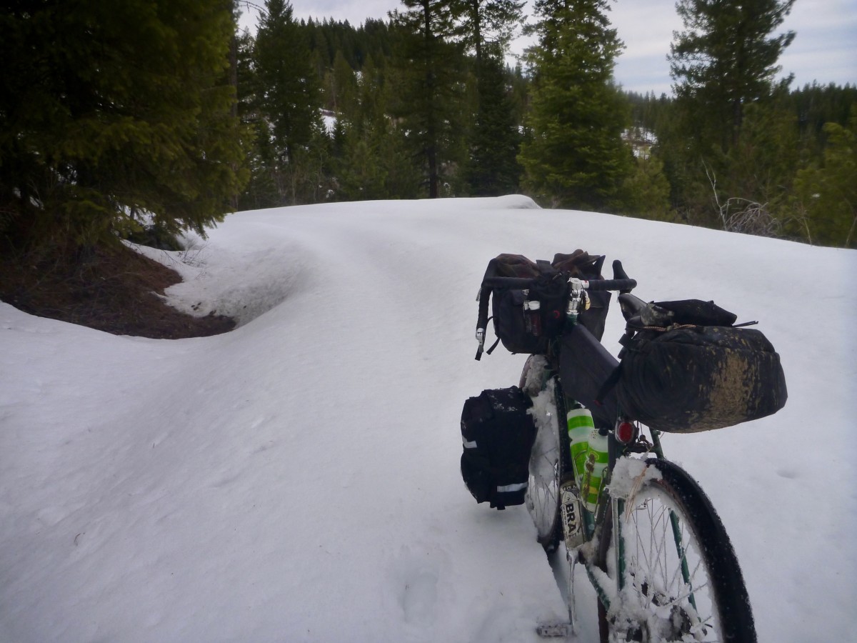
The snow continued to get deeper until it dragged at the bottom of my panniers.  The north-facing section of road just over the summit held drifts at least 3 feet deep.  I’m sure this road will be spectacular in a couple of months when all the snow is gone!  I don’t know how long it took to cover the 8 or 9 snowy miles but the time would definitely be measured in hours.

Clearly, these conditions were well outside the Pack Rat’s intended use.  Even a fatbike with 5″ tires would have been useless in snow that deep and wet.  I could have certainly saved myself some pain and suffering by turning back but I had made good time earlier in the day and knew I had sufficient daylight to get through.   I pushed, dragged, slipped and postholed over and down the pass, hoping that my planned campsite wouldn’t be under snow.

The campground still held some snow but there was plenty of dry ground.  I breathed a sigh of relief to have arrived and then set about drying my shoes and feet, eating food and doing my best to recover for tomorrow’s 90+ mile burn back to Boise.

I slept deeply and woke feeling surprisingly fresh after the previous day’s exertions.  I made breakfast, pulled on my frozen shoes and hit the road just as the sun began to peek over the eastern ridge.  The forest service road had yet to shake off the night’s chill.  Yesterday’s soft, wet mud and slippery slush had hardened into frozen dirt and roughly textured ice.  The Pack Rat excelled in these conditions, though I rode the icy sections cautiously and did walk a couple of slicker stretches.

Before long, the road reemerged from the trees and dried completely.  Conditions on the southbound leg started off similar to the northbound side. The cloud-filtered sun warmed the air and I enjoyed the (mostly) downhill grades and undulating terrain.  The Pack Rat hummed along, carrying speed through the troughs and over the top of the endless rollers.

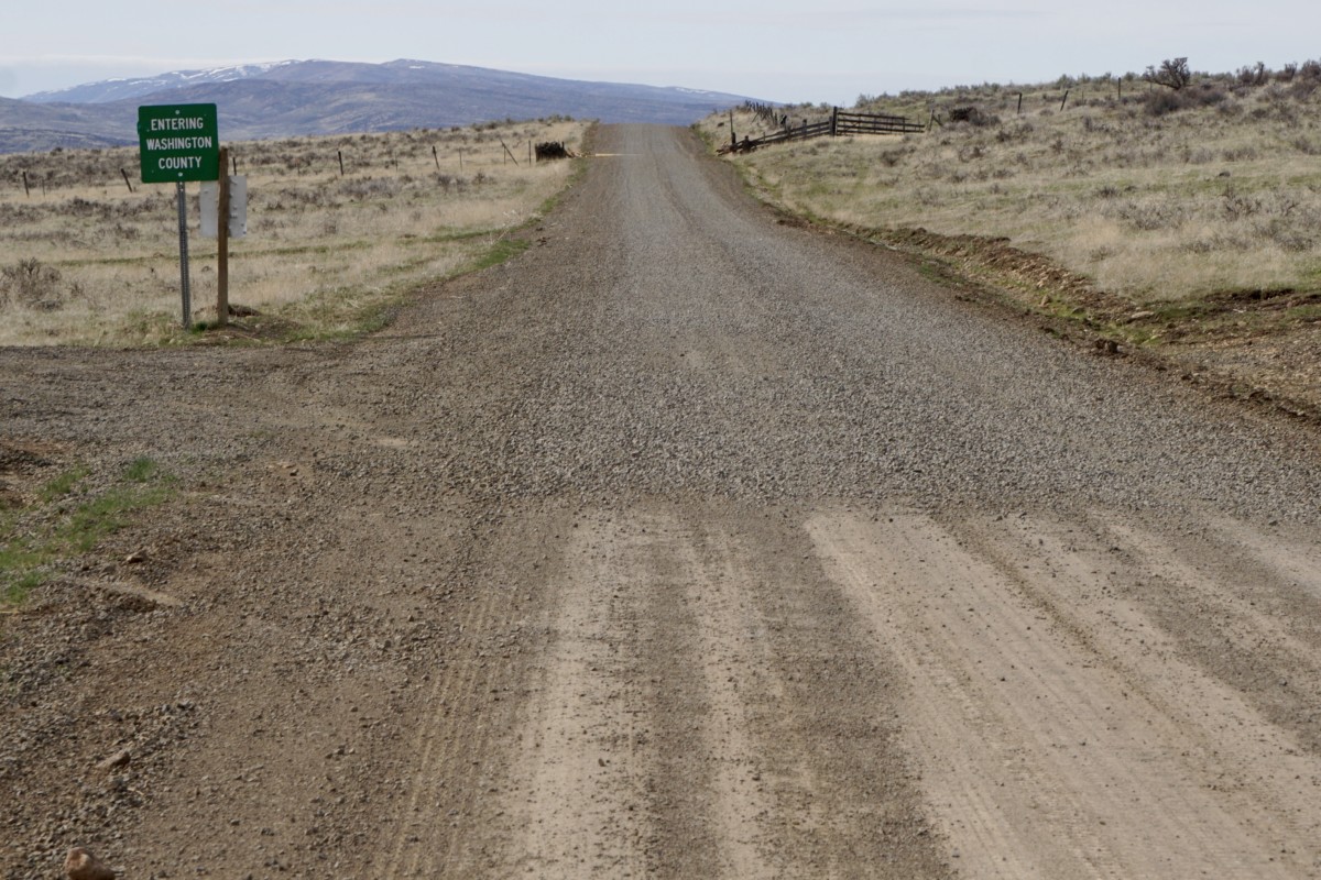
When we hit the Washington County line road conditions changed drastically.  The road had recently been graded and was evenly surfaced with 1-2″ size gravel.  I’d estimate the gravel had been laid no more than a week prior.  There were decent tracks laid down by auto traffic through most stretches but the rock lay in piles several inches deep in some spots.  Line choice was key, but the Pack Rat handled these challenging conditions admirably.  I’ve often felt that slimmer tires perform well in these kinds of conditions as they are narrow enough to push the loose rocks aside and grip on the hardpack beneath where a wider tire would float and roll on the top layer.

After turning off the recently-graded stretch of road conditions improved.  There were some seriously steep climbs on this leg of the ride that I would have wished away but the Pack Rat never held me back.  My legs had begun to tire and struggled to supply the necessary power.

Approaching the town of Emmett, it began to look like the highway would be a better option than returning via yet more nasty rollers in the Eagle foothills.  My body was tired and shadows were getting long.  We spun our way down the paved highway shoulder into the valley, turned to the east and finished the final few miles back to Boise.  My pedal strokes were weak and I was happy to be on a bike that rolled efficiently and didn’t ask for much leg strength to maintain forward progress on the asphalt and chipseal.

Overall, I came away from this ride even more excited for the Pack Rat’s potential.  It may not be your go-anywhere touring bike.  There are plenty of roads, tracks and trails over seriously rugged terrain in Idaho where a little more bike (Ogre, Troll, ECR, Bridge Club, etc.) would be a better fit.  It also won’t carry a transcontinental load as well as the Long Haul or Disc Trucker.  However, if you want a bike to travel a mix of dirt and pavement with a light-to-medium load on the weekend, pull double-duty on the weekday commute and have a good time doing it, the Pack Rat is worth your attention.  If nothing else, it’ll get you out of town and into the fun stuff in a hurry!

Categories
Idaho Our Trips

Little Weiser April Fool’s Errand: March 30 – April 1, 2018

Spring has arrived here in Boise!  Time to strike out on our first overnight trip of the year!  Here’s the route we’re planning to attempt:

https://ridewithgps.com/routes/27089400

The broad valley north of the Payette river and east of the West Mountain range has offered hospitable springtime conditions in years past.  Last year we rode to the Montour campground and did a big, looping day ride back to camp on the “Grindola” route.  Photos on this post were taken over that weekend in May 2017.  This year we’re thinking of heading a little farther north into the Payette National Forest and (hopefully) spending the night on the Little Weiser River.  Come join us!

First of all, let’s get the disclaimer out of the way.  This is not a bike event.  This is a self-supported, weekend bike ride with a group of friends.  All riders are responsible for their own safety and enjoyment, should come prepared to be 100% self-sufficient and have their own self-rescue or bailout plans in place.  Do not count on cell phone service.  We are offering a route suggestion, some potentially useful (or potentially inaccurate) information and nothing more.  That said, riding bikes is fun, overnight rides are even more fun and we welcome any and all riders who want to join in for any portion of the weekend’s journey!

OK, let’s get to the good stuff!  The plan is to close the shop a couple of hours early so we can leave Bike Touring News HQ at 4pm on Friday, March 30.  That’s right, the shop is CLOSING EARLY!  That will give us plenty of daylight for the 27-mile pedal through the Eagle Foothills and down the other side to the Montour WMA campground.

The descent down the Johnson Creek road hasn’t received any maintenance (that we know of) at least since last summer, maybe longer.  It is likely to be in poor shape and may not be 100% rideable.  There is one extended section where the creek has taken over the road.  This mile-ish stretch will likely be running with at least a couple inches of water and is paved with round, sometimes loose babyhead rocks.  Be prepared to walk/carry your bike if the going gets rough.

The Montour Campground is tucked in a shady grove just on the north side of the Black Canyon Reservoir section of the Payette.  The campground will likely still be closed for the season but water has flowed and bathrooms have been unlocked in previous springs.

The Montour Country Store and Triangle Restaurant (marked on the RideWithGPS route) are just a short pedal away for meals, beverages and general resupply.

Day 2 will cover around 50 miles of paved and unpaved roads.  We’ll gradually climb northbound through Ola with a probable stop at the Ola Cafe for lunch before continuing into the fringes of the Payette National Forest.  The Cafe will be the last on-route resupply until we pass through Emmett on the way back south, so stockpile those calories!

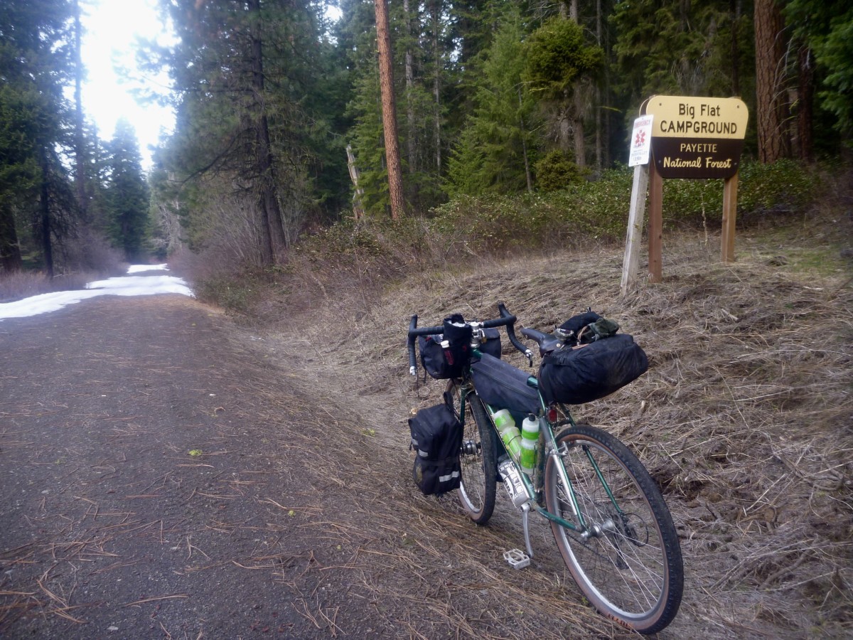
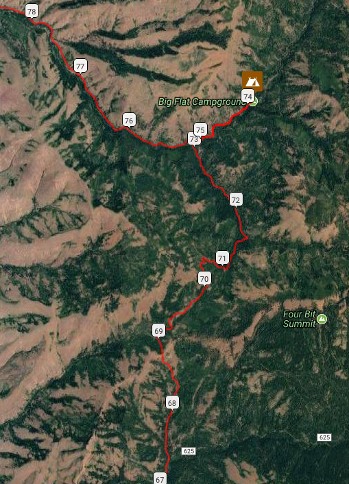
The day will end with the climb over the Mill Creek Summit and descent to the Little Wieser River, camping at the Big Flat campground or thereabouts.  This will be new territory, so we’re not certain what to expect.  We’ll just have to go there and find out.

Word from the Ranger on duty at the Council district office is that the roads up to and over the Mill Creek Summit (topping out right around 5,000 feet) should be snow-free.  I (Ryan) was surprised to hear that given the snow line here in Boise but we’ll just have to go there and find out.

Per the Ranger, the campground is closed but still useable – though toilets may be locked and water shut off – or we may seek an alternative spot to dispersed camp.  Will there be fish in the river?  We’ll just have to go and find out.

Day 3 will be the big day mileage-wise with a 90+ mile push back to Boise.  However, we’ll gradually be losing elevation and the roads should be pretty fast as we head southbound toward Emmett.  We’ll refuel in town for the climb out of the valley before dropping back to Boise through the Eagle foothills.   With an early start on Sunday morning we should have plenty of daylight for the return trip.

Can’t get out of work early on Friday?  Looking to trim some miles or skip the ride out of town?  Park your vehicle at Montour and ride Saturday and Sunday!  Shorter overnight and day ride options also abound in the area.  Choose your own adventure!

Weather:  NOAA weather near Big Flat CG (near high point of the ride)  Lows are forecast to be right around freezing, highs in the low-mid 50s.  Only a slim chance of precipitation, but it is springtime in Idaho so be prepared for anything.

Bike Choice:  Much of the route travels decently paved or maintained dirt roads.  Conditions will vary depending on level of maintenance but at least some rough conditions should be expected.  The Johnson Creek descent is likely to offer up the roughest conditions we encounter.  Any good dirt touring bike with 2″ish tires will probably do fine over 95% of the route.

Questions?  Email [email protected], call the shop (208-806-2111) or stop by!  See you out on the road!