This post is a placeholder for comments on the specific section of the Idaho Hot Springs Mountain Bike Route maps published by Adventure Cycling Association. People who have ridden this section of the route are encouraged to report on current conditions by using the Comments. The reliability and timeliness of the reports depend solely on the contributors. Bike Touring News takes no responsibility for any outdated or inaccurate information here. For an index of all the sections of the route please see this page.
Category: Our Trips
This post is a placeholder for comments on the specific section of the Idaho Hot Springs Mountain Bike Route maps published by Adventure Cycling Association. People who have ridden this section of the route are encouraged to report on current conditions by using the Comments. The reliability and timeliness of the reports depend solely on the contributors. Bike Touring News takes no responsibility for any outdated or inaccurate information here. For an index of all the sections of the route please see this page.
This post is a placeholder for comments on the specific section of the Idaho Hot Springs Mountain Bike Route maps published by Adventure Cycling Association. People who have ridden this section of the route are encouraged to report on current conditions by using the Comments. The reliability and timeliness of the reports depend solely on the contributors. Bike Touring News takes no responsibility for any outdated or inaccurate information here. For an index of all the sections of the route please see this page.
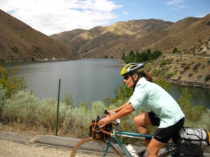
Yes, I coined a new term; “A24O”- for “about 24 hours over-nighter”. The “S24O” or “sub 24 hour over-nighter” seems too extreme. Too much pressure to return home in less than 24 hours, especially from Boise where the distances to decent camping spots are greater than in some other shires.
We rolled out the front door at about 10 AM Saturday morning and by shear luck, even though it would be almost 100 degrees by the afternoon, there was a nice cloud cover most of the morning which even sprinkled a little rain. We followed the Boise Greenbelt out past Harris Ranch to Lucky Peak Dam. There is a four mile climb to the Hilltop store, which is open again (hope they can keep it going) and actually has a nice selection of beer, so there was no need to have lugged our adult beverages up that hill! A fast descent and a sharp right past the high bridge brings us to Spring Shores Marina. It’s another 5 1/2 miles of pavement before the road turns to dirt/gravel/sand which is severely washboarded in places by the almost steady (on the weekend anyway) traffic of recreationalites with their recreational vehicles.
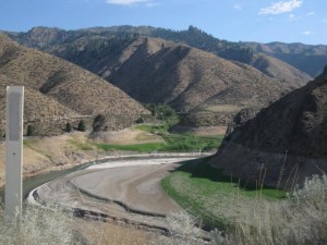
Arrowrock Reservoir is bigger than I realized. We followed the road along the upper shoreline for about 14 miles to the upper end of the reservoir where the Middle Fork of the Boise River flows freely again. This is where the climate becomes more alpine too. Pine trees begin to replace the clumps of Black Locust growing at the lower, dryer elevations. Indeed, it seems a bona fide forest at Willow Creek Campground.
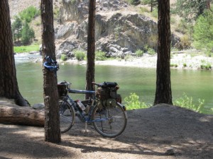
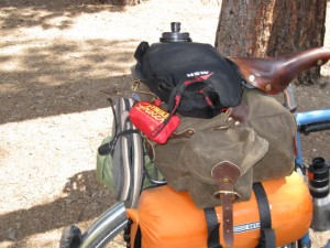
I’m still undecided about the best bike for this kind of trip. Most of the miles are on pavement but the unpaved sections can be sort of jarring and tiring. I rode my touring bike with 700x35c tires while Sky King rode her Bleriot with 650bx42mm Grand Bois Hetre tires, and neither one of us had any significant problems. The smooth tread tires were nice on the paved sections. Bikes with even more voluminous tires would flatten out the bumps a little on the unpaved sections and provide better traction I think. So there are compromises on a trip like this. We will be covering the same ground on the last day of the upcoming Ketchum to Boise ride and we both want fatter tires. Sky King will be buoyed by 26″x2.4″ Schwalbe tires on the Disc Trucker. The Surly Big Dummy has unexpectedly risen to the top of my own short list of off road touring bikes. The frame is designed to fit tires up to 2.5″ wide, even if tire selection in that size is a little bit limited. And the long wheel base distributes the weight of the rider and the load more evenly between the two wheels resulting in better traction and more stable handling….theoretically. The longer wheelbase undoubtedly would smooth out the chatter bumps on these gravel roads too. In more remote areas drinking water can be the major challenge to doing off road back-country rides fully self-supported. With its 200 pound load capacity, not including the rider, and its capacious bags the Big Dummy unlocks that conundrum. The only downside I can see is if the need arose for some bushwhacking or log hopping to get to that perfect campsite, but that is not a deal breaker.
Oops….. this post has encountered a bit of metaphorical sand and could easily slide over the bank into the weeds of B.R.O.C.D. (bike related obsessive compulsive disorder). Careful, just a little body english, don’t over correct…..right, back on form. So figure on a solid 5 hours to do this 40+ mile ride one way on a loaded bike. There is drinking water at Hilltop, at Spring Shores Marina and at the Willow Creek Campground. The campground is a no fee forest service facility with picnic tables and plenty of trees and good access to the river. The area is very popular on summer weekends and the auto traffic is heavy, especially on Sunday afternoon.
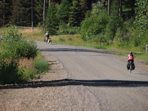
Asa thinks I’m an (expletive deleted) because I mock him for naming his bike Rocinante. But it’s just because the Bike Hermit is a rough, illiterate man. And because I’m jealous of him. He is leaving next month for a year long bike touring trip in Europe. He is twenty something. Actually I am not jealous, I simply hate him…..just kidding Asa.
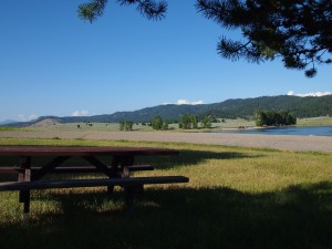
There were three other bike touring novices on our trip around Lake Cascade this weekend. But every one of them represented!
A bout of dehydration resulting in nausea, headaches and chills for Paul prompted Scott to retrace the previous thirty miles in order to fetch a car for the rescue. Meanwhile we fed Paul ibuprofin and an electrolyte replacement drink…he actually recovered enough to put me in a spot of bother on the last day while trying to stay on his wheel. Scott met us at the second night’s camp and drove into town to buy beer and steaks! That’s what I call bike touring!
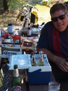
Exercise induced dehydration can actually be real problem when touring. According to Wikipedia- “Physiologically, dehydration, despite the name, does not simply mean loss of water, as water and solutes (mainly sodium) are usually lost in roughly equal quantities to how they exist in blood plasma” which means that simply drinking water can still result in dehydration if electrolytes are not also replaced. In fact, drinking too much water without replacing other nutrients can lead to hyponatremic dehydration, basically a low level of electrolytes, sodium in particular. Fruit juices, coconut water, sports drinks, milk, fruits and vegetables contain electrolytes. Fruit juices can contain a good deal of sugar which makes them more difficult for the body to digest and use. I prefer an electrolyte tablet that can be dropped into a water bottle because the tablets are small and easy to carry. Nuun brand tablets have no sugar and a little bit of effervescence, and they taste pretty good. Checking urine color can be an indicator of hydrated-ness, should be light, like lemonade, not dark, like apple juice.
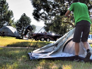
The second night, we shared the full to overflowing campground with some very impressive RVs, pickup trucks and bass boats. At O Dark:30 in the morning a dozen diesel motors clattered to life and I extruded myself from my hammock to watch the start of the day’s bass tournament. After heating some water for coffee I wandered down to the boat ramp to watch the launch…all the boats were already in the water!…these guys have it down. The official’s boat was being circled by the school of bass boats as the lights on its mast changed from red to yellow to green. Then, in a display that would make any American (or OPEC member) proud, one by one the boats took off at 80 m.p.h. to their preferred fishin’ hole. They would fish and drive their boats really fast until 3 PM when the official weigh in took place. Almost wished I could’ve stayed.
It is well known that the Bike Hermit can be socially challenged. I enjoy being on my own and unknown in new to me places. But I’m finding that touring with other people can be rewarding. Something about it seems to bring out the best in a grumpy old man. I bear the discomfort and I realize that most of the others are committed to the well being of this little temporary micro-society we have formed. Feelings of sovereignty are put aside and group mindedness prevails…nobody wants to be the one who ruins the trip for the others. There is a tacit understanding that this is no place for competitive instincts.
Seeing how people solve the problem of carrying gear on the bike is instructive and entertaining too. From trailers to panniers to frame bags to wire baskets, there is no right or wrong way. This old hermit is looking forward to the next group tour!
A picture says 1000 words. Here’s a bunch of words. It would be impossible to describe this trip otherwise. Thanks to all the participants and to the photographers and videographers.
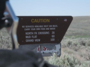
The Great Owyhee Uplands Bicycle Tour from Tad Jones on Vimeo.
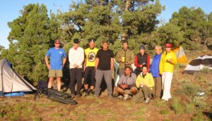
More information on the BLM site.
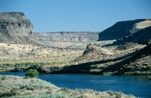
Day One Tuesday, April 17
Boise to Celebration Park – Total distance; 43 miles
I stare at the 22 oz. Rogue Dead Guy Ale for about five minutes before deciding not to buy it because I don’t want to carry it the rest of the way to Celebration Park, and surely there will be be at least a convenience store in Melba where I can get a decent beer to drink as I set up camp. There is indeed a market in Melba but it looks pretty homemade and, no you can’t buy singles but there are tallboy cans so I buy one of the least offensive…24 ounces of PBR. I often wonder why out of the way places don’t stock flavorful beer, since the distributors are the same ones that deliver the Bud Lite. And, is it just me or do real men not drink micro-brews? Bike touring forces one to face the weighty, existential questions.
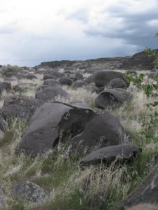
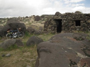
When the Bonneville Flood slammed through here a few years back, it tore chunks of volcanic rock the size of school buses off the walls of the Snake River Canyon. Bouncing along under water the chunks were rounded and smoothed and then deposited downstream…a jumble of huge boulders in the narrowest part of the canyon and a more even distribution of smaller boulders where the canyon widens out and the water slowed down.
I scout out what appears to be the best place to hang the hammock and get after it because the clouds are turning blacker and more menacing and I can see lightning to the north. I am ecstatic that the parking lot is empty and I will have the whole place to myself. Then a car comes fishtailing down the gravel road from the “east campground” and out the entrance road and after the dust settles I hear sounds of a beer blast coming from the same direction. Oh well, that’s what they make I-pods for.
Various Boy Scouts have made Eagle projects out of building structures at Celebration Park and so there is a network of boardwalks and decks and even an atlatl range. There are bathrooms and a visitor center and the place starts humming in the morning with park staff getting ready for the busloads of fifth and sixth graders coming that day. That entertains me for a while but, with peace and quite my main objectives for the trip, I decide to push off (quite literally as will soon become apparent)
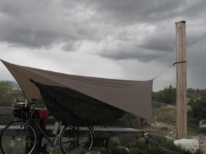
Day Two Wednesday, April 18
Celebration Park to Swan Falls Dam – Total Distance; 16 miles
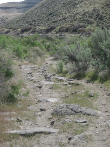
Google Maps shows what looks like a road along the Snake River between Celebration Park and Swan Falls Dam. After maybe a mile or maybe two, motor vehicles are restricted and the road becomes double track and then single track and in places almost non-existent. I spend some time pushing the bike through loose sand encouraged by Wendell’s report after riding here last week that the loose sandy section is not too extensive. But with a loaded bike weighing probably close to 70 pounds and relatively skinny 700cx32 tires I end up pushing quite a bit. But there is no rush and the scenery is on par with that of southern Utah, so I push along and ride when the ground is firm enough.
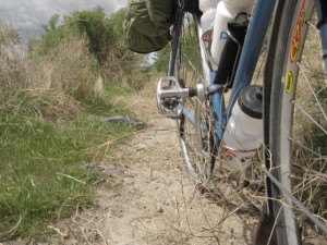
Other sections of the path are interspersed with melon sized rocks which means I ride (scoot) with one foot clipped in and the other pushing. Even further on, where the trail occupies a narrow shelf between the river and the canyon walls, and is hemmed in by willow bushes, tumbleweeds have collected in the path. They are impossible to miss and every time I ride over one it attaches to fenders/chainrings/derailer/chain/wheels….so I am stopping every twenty or thirty feet to pull them out.
Motor vehicles are restricted over about eight of the twelve miles between Celebration Park and Swan Falls Dam. The last four miles to the dam are on gravel road. Swan Falls Dam is owned by Idaho Power and there is a day use area with boat ramps and picnic tables and bathrooms, but no camping. There is too much activity and noise around here anyway so I cook some lunch, refill the water bottles and head back down the gravel road and about half a mile down the car-less path and find a spot to pitch shelter just before the rain comes again.
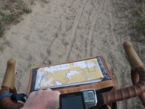
Day Three, Thursday, April 19
Total Distance; 47 miles
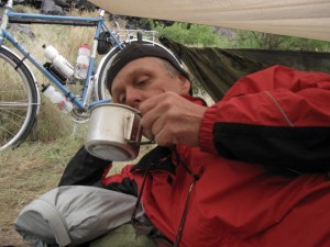
I am in the heart of Morley Nelson Snake River Birds Of Prey National Conservation Area. Laying under my improvised shelter this morning, waiting for the rain to stop, I can hear many species. Crows (mostly), mourning doves, geese, ducks and loons? Sometimes I am sure I hear people but it is just the birds laughing at the old guy hiding under a tarp. Climbing up the switchbacks out of the canyon this morning I stop to watch a golden eagle floating overhead and he is soon joined by three others. The steepness of the terrain means that they are very close when they pass over and I watch them for several minutes. The whole time I spend watching, none of them flap their wings. Must be nice. Last night I startled a pair of pheasants before they startled me with their drum beat winged escape. I didn’t encounter any vampires but I did observe a couple of George Romero-esque zombies disguised as sight-seeing tourists.
The eight miles of trail along the river was definitely the highlight of the trip and made the jaunt more than worthwhile. When I do it again I will have a bike with fatter tires. A fat bike like the Surly Pugsley would be perfect and I think the whole trail would be rideable even with a loaded bike. 700×40 or 26″x2″ tires would be the minimum cross sections for tires through here I would think. Any bike capable of the whole trip without driving would necessarily be a compromise; one that can handle the off road sections while still being able to cruise on the pavement.
Taking it slow in the Hagerman Valley
As the Bike Hermit is deep into his remodeling project, Sky King jumped at the chance to do some great slow pedaling with the ladies. This turned out to be a perfect way to enjoy spring weather, work in bird watching and be reminded that life is about the journey, not the destination.
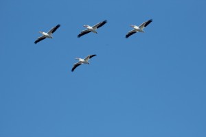
Lisa, Julie and I spent hours exploring the Snake river along State Highway 30 just south of Hagerman, Idaho and then more hours at Bruneau Sand Dunes. Our only goals were to have fun and enjoy the abundance of waterfowl. Spinning along we never passed up the opportunity to stop, grab the binoculars and take in the views. We took advantage of soaking in the pool at Miracle Hot Springs – even admired the alligator.
Waking up to the sound of Thousand Spring’s waterfalls made for a delightful start to our ride.
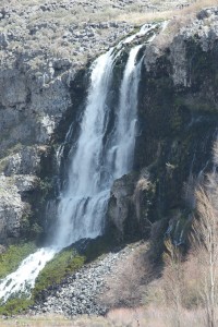
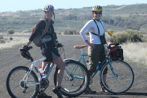
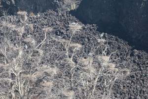
Being open to meandering lead to sweet surprises. One of my favorites was observing the Heron’s working on the nests in the rookery. There were at least two dozen birds nesting in a compact group of trees. Would be fun to come back and watch “hatchling” flying lessons.
Riding anywhere in Southern Idaho in early spring, means laughing at the yellow bellied marmots and their insatiable curiosity.
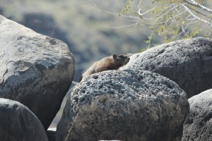
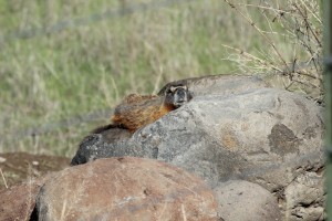
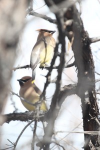
Finally no birdwatching trip would be complete without the harrier hawk in the sky, a few ducks in the pond and the beautiful wax wings.
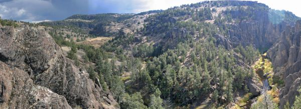
“a primitive and unconfined type of recreation”
Customer and friend Wendell came in the other day with his new Salsa Fargo “adventure” touring bike. As we were talking about places to go with such a bike he mentioned the Owyhee Uplands Backcountry Byway (which sounds much better than the local name of Mud Flats Road).
Here is a mostly dirt road on mostly Bureau of Land Management real estate connecting Grand View, Idaho and Jordan Valley, Oregon through the Owyhee Uplands, one of the largest areas of un-fragmented sagebrush habitat in the West 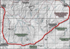 .
.
The Byway can be reached through Jordan Valley, Oregon 80 miles southwest of Boise or through Grand View, Idaho 70 miles southeast of Boise. It is 103 miles between the two towns, 74 of those miles on unpaved surfaces. I’m sure it could be ridden in one grueling day but that is not the point. Experiencing what’s out there is the point. Three days and two nights one way seems reasonable.
2 or 3 options present themselves:
1) drive to either Grand View or Jordan Valley, leave a car and drive to the other end. ride the Byway and shuttle back to the start.
2) drive to one end and do the roundtrip.
3) start in Boise and ride the loop.
There are no services between Grand View and Jordan Valley. There is water along the way but it is best not to drink it without boiling it or treating it first. If chosing the first option above it might be possible to stash a cooler loaded with extra water and food and other refreshment at some point along the route and retrieve it when shuttling back. If taking the second or third options provisions will need to be made to either boil or filter or otherwise treat enough water for drinking. Carrying enough for even three days would be awkward and heavy.
Wide, stout tires will make the loose, rocky washboarded sections more comfortable. I’m thinking 700c x 42 or 26″ x 2.3 or 650b x aswideaspossible. Of course a fatbike such as the Pugsley or Moonlander deserve serious consideration. 4 to 5 inch wide tires inflated to 10 or 12 psi would float over the rough stuff and track straight in the loose gravel and sand. Then they could be pumped up to 20 or 25 psi for the paved sections.
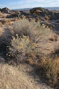
Camping is allowed in non-designated areas on BLM land. But if you choose to do this, please remember to stay on established roads and trails, “leave no trace,” and “pack it out.” Along the Byway there are parcels of private land and the BLM recommends purchasing one of their surface management status maps available for a small fee from the BLM (208)-373-4007) Ask for the “Triangle” section. Respect private property and avoid trespassing. There is one developed campground at the North Fork Recreation Site about 32 miles from Jordan Valley.
The road is sometimes impassable from late November through March due to snow. The surface will also be slick and messy if it is wet and that would be no fun. Daytime temps in the summer can reach triple Fahrenheit digits and the nights in the high desert can be cold anytime of year. So, plan accordingly.
With all those caveats in place I can say that the more I have researched this, the more excited I am to ride in and explore this area. We have lived in Boise for over twenty years and, until we got touring bicycles, never made the effort to see some of the amazing, remote areas in our back yard. The byway overlays several different vegetation zones – riparian zones along the rivers, the sagebrush steppe, salt desert shrub landscape and juniper woodlands. The Owyhee Canyonlands are home to one fifth of the world population of native California Bighorn Sheep. There are over 500 thousand acres of designated wilderness areas in the Owyhee Canyonlands. One half. million. acres. You have some ‘splorin to do, Lucy!
View Larger Map
Sometimes it feels as though everyday is a brand new kick in the teeth. I’m no different from anybody else. We all have our own personal Mt. Everest to climb and sometimes it feels like we are on the Hillary Step….our oxygen bottle has quit working and our crampons are loose.
From time to time, I need to escape. The best way I know of to do that is to load onto my bike everything I need in order to live for a few days and start pedaling. It might appear as if I’m being selfish to do that. It might appear to be a little bit odd and not that much fun. But I know that for those few days, I am a different person with different problems and a different set of needs, and the person I was, with his problems and worries, is far, far away.
I made plans to ship my bike to Portland two weeks ago and then ride it back to Idaho after the Oregon Manifest Constructor’s Challenge, which we were attending as members of the press. Here are some random reports and thoughts from my ride across Oregon:
Riding in Portland
I am continually amazed by the number of people who really use their bicycles in Portland and by the infrastructure for bikes that is in place. Dedication to bicycle travel is much more than lip service here.
The Boogey Man Forest
When night falls in these Doug Fir and Ponderosa Pine old growth forests, it falls like a drunken man who blacks out when his head smacks the pavement. It is not possible to see ones hand in front of ones face. Alone in the National Forest campground and completely covered up by darkness, I slept like a dead man for 11 hours.
KOA Kamping, and Kross Kountry Riding
I could have got by cheaper than the $24.00 I was charged for a tent site at the KOA by finding an RV park with tent sites. But I knew KOA’s have nice clean facilities with showers and laundry, and I was wet and tired. Next day I used the Droid to find an alternate route to the state highway rather than backtracking 7 miles back to Madras. A little scenic detour on dirt roads and I was golden.
Wild Camping
In the Ochoco National Forest I had the opportunity to spend $13.00 for a tent site without so much as water. I opted to ride another mile and pitch camp a hundred yards off the highway in the forest. I actually felt pretty comfortable for my first wild camping experiment, but I was extra careful with the stove because fire hazard was off the charts in Oregon this year.
Lucas
Lucas has been on the road for about ten weeks, having started in Central Park in New York City. He was still fired up though and he said he didn’t really have any expectations but was always excited to see what was around the next corner. An attitude I was to remember and take to heart for the rest of my trip.
Oregon State Parks
Clean, well maintained and cheap. Five dollars for a tent site in the hiker/biker areas in the Oregon State Parks includes all the facilities, such as showers. Oregon is serious about encouraging bicycle travel.
Water Lady
Just outside of Prairie City begins the 1700 foot climb to Dixie Pass which tops out at 5276 feet. Near the top a car pulled off and the woman who was driving asked if I needed anything. I let her fill my water bottles as she told me she had ridden this pass in 1996 on her way across the US on bike. Now she always tries to stop when she sees tourists to see if there is anything they need. Very thoughtful and I appreciated it.
Serendipity
After Dixie Pass I knew I still had two more summits that day before stopping for the night. In my mind the 5100 foot pass came first and then a 4500 footer. At the top of the big pass I again checked my maps and realized that the shorter climb had come first and it was all downhill to Unity Lake State Park. Nice surprise!
Then when I finally pulled into the park, the ranger happened to be there and told me that even though it was not shown on their board, they did indeed have hiker/biker sites and he pointed them out to me. I decided to appreciate the little things that did work out today instead of focusing on the fact that park was full to overflowing with hunters and their noisy, smelly rigs and their impossibly bright lanterns and spotlights.
Notes to self:
Get some better sunscreen for my lips. I still have blisters 3 days later.
Get a handlebar clamp for the Droid
Bring the video camera
Bring a small pad to use to sit on
