When asked how to get between Boise and Mountain Home on a bicycle without riding on I-84 and without riding the Old Oregon Trail, which is dirt road, I haven’t been able to give a good answer. Until now.
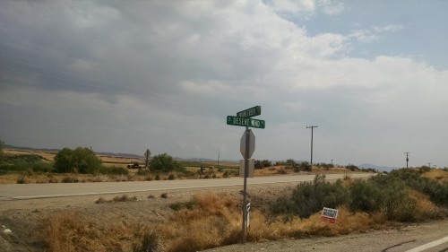
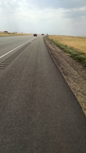
From Bike Touring News to the eastern most exit off of I-84 it is 14 miles. Take Federal Way south past Gowen Road to Memory Lane and turn right to the freeway Exit 59B. Actually, this route does mean about 8 or nine miles on the freeway, but the shoulder is wide and smooth and rumble strips divide it from the traffic. Ride to Exit 71 Mayfield Road. Turn left across the freeway to Desert Wind Road. Turn right and follow Desert Wind as it becomes W. Tilli Road. Turn right on Ditto Creek Road which crosses I-84 to the junction with Old Oregon Trail Highway. Turn left and parallel the freeway into Mountain Home. This is not the most scenic route in the world, but it will get you to Mountain Home and from there Old Highway 30 takes you to points East.
Tag: lightweight touring
Lightweight touring might be hard to define. Everybody is different and has different desires when bike touring.
Taking it slow in the Hagerman Valley
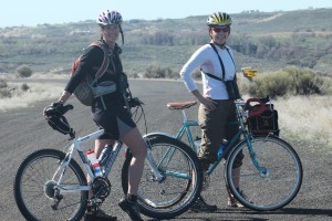
As the Bike Hermit is deep into his remodeling project, Sky King jumped at the chance to do some great slow pedaling with the ladies. This turned out to be a perfect way to enjoy spring weather, work in bird watching and be reminded that life is about the journey, not the destination.
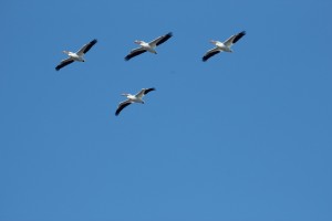
Lisa, Julie and I spent hours exploring the Snake river along State Highway 30 just south of Hagerman, Idaho and then more hours at Bruneau Sand Dunes. Our only goals were to have fun and enjoy the abundance of waterfowl. Spinning along we never passed up the opportunity to stop, grab the binoculars and take in the views. We took advantage of soaking in the pool at Miracle Hot Springs – even admired the alligator.
Waking up to the sound of Thousand Spring’s waterfalls made for a delightful start to our ride.
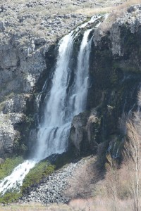
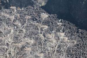
Being open to meandering lead to sweet surprises. One of my favorites was observing the Heron’s working on the nests in the rookery. There were at least two dozen birds nesting in a compact group of trees. Would be fun to come back and watch “hatchling” flying lessons.
Riding anywhere in Southern Idaho in early spring, means laughing at the yellow bellied marmots and their insatiable curiosity.
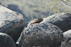
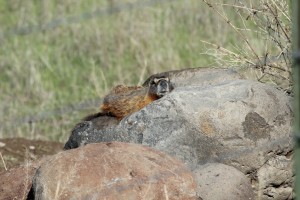
Finally no birdwatching trip would be complete without the harrier hawk in the sky, a few ducks in the pond and the beautiful wax wings.
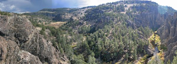
“a primitive and unconfined type of recreation”
Customer and friend Wendell came in the other day with his new Salsa Fargo “adventure” touring bike. As we were talking about places to go with such a bike he mentioned the Owyhee Uplands Backcountry Byway (which sounds much better than the local name of Mud Flats Road).
Here is a mostly dirt road on mostly Bureau of Land Management real estate connecting Grand View, Idaho and Jordan Valley, Oregon through the Owyhee Uplands, one of the largest areas of un-fragmented sagebrush habitat in the West 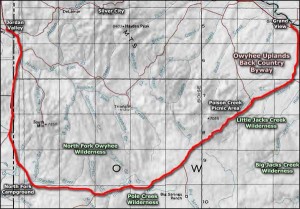 .
.
The Byway can be reached through Jordan Valley, Oregon 80 miles southwest of Boise or through Grand View, Idaho 70 miles southeast of Boise. It is 103 miles between the two towns, 74 of those miles on unpaved surfaces. I’m sure it could be ridden in one grueling day but that is not the point. Experiencing what’s out there is the point. Three days and two nights one way seems reasonable.
2 or 3 options present themselves:
1) drive to either Grand View or Jordan Valley, leave a car and drive to the other end. ride the Byway and shuttle back to the start.
2) drive to one end and do the roundtrip.
3) start in Boise and ride the loop.
There are no services between Grand View and Jordan Valley. There is water along the way but it is best not to drink it without boiling it or treating it first. If chosing the first option above it might be possible to stash a cooler loaded with extra water and food and other refreshment at some point along the route and retrieve it when shuttling back. If taking the second or third options provisions will need to be made to either boil or filter or otherwise treat enough water for drinking. Carrying enough for even three days would be awkward and heavy.
Wide, stout tires will make the loose, rocky washboarded sections more comfortable. I’m thinking 700c x 42 or 26″ x 2.3 or 650b x aswideaspossible. Of course a fatbike such as the Pugsley or Moonlander deserve serious consideration. 4 to 5 inch wide tires inflated to 10 or 12 psi would float over the rough stuff and track straight in the loose gravel and sand. Then they could be pumped up to 20 or 25 psi for the paved sections.
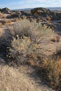
Camping is allowed in non-designated areas on BLM land. But if you choose to do this, please remember to stay on established roads and trails, “leave no trace,” and “pack it out.” Along the Byway there are parcels of private land and the BLM recommends purchasing one of their surface management status maps available for a small fee from the BLM (208)-373-4007) Ask for the “Triangle” section. Respect private property and avoid trespassing. There is one developed campground at the North Fork Recreation Site about 32 miles from Jordan Valley.
The road is sometimes impassable from late November through March due to snow. The surface will also be slick and messy if it is wet and that would be no fun. Daytime temps in the summer can reach triple Fahrenheit digits and the nights in the high desert can be cold anytime of year. So, plan accordingly.
With all those caveats in place I can say that the more I have researched this, the more excited I am to ride in and explore this area. We have lived in Boise for over twenty years and, until we got touring bicycles, never made the effort to see some of the amazing, remote areas in our back yard. The byway overlays several different vegetation zones – riparian zones along the rivers, the sagebrush steppe, salt desert shrub landscape and juniper woodlands. The Owyhee Canyonlands are home to one fifth of the world population of native California Bighorn Sheep. There are over 500 thousand acres of designated wilderness areas in the Owyhee Canyonlands. One half. million. acres. You have some ‘splorin to do, Lucy!
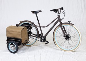
As the Bike Hermit makes his way back to the bike cave from Portland on Chief, Sky King thought it would be a good idea to provide a link to the updates on the Oregon Manifest Website. Some high quality photos and interviews with the builders and the judges.

Guaranteed on any bike tour, you are going to sweat. Ending the day with a shower is one of the ultimate rewards on a bike trip (ranks right up there with a cold beer). On our recent tour on the Olympic Peninsula we spent each night at a campground but still ran into unexpected issues with using the showers. Many campgrounds have “pay as you play” showers so be sure to tuck quarters into your pannier. We arrived at one site “afterhours” and discovered they didn’t take quarters but used tokens that needed to be purchased from the camp host… Well hell, what to do. From previous trips we have devised a great technique for impromptu showers, we call it the two water bottles and a camp towel trick. Simply heat water, pour into two water bottles. At the campsite that had the shower but needed tokens, I took my water bottles, Dr Bonner’s liquid soap, my camp towel and my bike shorts into the shower stall. I wet my hands, applied a small amount of soap and lathered all the priority body parts that need attention. Then I used my two water bottles of warm water for rinsing. While not as deluxe as a 3 minute shower, it takes the sweat layer off and I can sleep comfortably.
Why the bike shorts in the shower? We travel with two pairs of shorts and every night apply a small amount of diluted Dr Bonners to the chamois of the shorts worn that day and rinse well. The shorts hang off the hammock for the night and if still damp in the am are securely draped over my sleeping bag for the days ride.
As noted we travel with hennesey hammocks so no tent for a private spit bath, No worries, the rain fly makes a nice shower curtain for the two bottle shower.

In addition to the camp towel and Dr Bonner’s, two other must have items I tuck into my pannier – Nutrogena Face Towelettes and baby wipes. Both have travel packs. It is nice to grab a face towelette and get the grime off and baby wipes … well let’s just say what did we do without them.
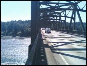
Riding across the Agate Pass Bridge between Bainbridge Island and the Olympic Peninsula in Washington State on a fully loaded touring bike is one of the most frightening experiences I have had on a bike. The “shoulder” of the road way is divided by elevation, half is at road level and half is raised about 8 inches. So what is left is two unusable strips about 18 inches wide.
As I watch my wife ride over I choke down my fear of the unimaginable. She actually timed it perfectly by starting off just in front of a big box van which would have difficulty passing her with the heavy traffic in the opposite direction and “took the lane”, in other words, she rode in the depression the right tires of innumerable cars have left in the pavement. So every vehicle behind the box van just had to take a deep breath and use the big pedal beside the gas pedal.
Expert that the bike hermit is, he decided he could ride on the elevated part. Which was no problem until a gust of wind almost blew him off the curb and into oncoming traffic. When his heart rate slowed sufficiently and there was a break in traffic he continued across….. taking the traffic lane.
Sometimes you have to hold up traffic to avoid dying. Just remember, you have as much right to use that section of the road as an automobile does. And remember that most people are not psychopaths and they will not run over you. If you act predictably and make sure that motorists see you, without being obnoxious, then you can co-exist. Just assume that the motorist doesn’t see you and ride very defensively. Every state has different laws governing bicyclists and a tourist can’t be expected to know all of them, but I think common sense and riding with confidence, as if you belong, can go a long way.
Of course, this was a relatively short bridge and I don’t recommend this for every situation. You should check local conditions and if a road or bridge appears to be too dangerous then find another route or another way across.
August 3, 2011
Crack….Thump….Whoomp
I’m flat on my back on the ground.
“Are you OK?”
“Yeah, I’m OK…….are you OK?”
“Yeah”
For all of the trees around here, most of them are massive cedars and they are too big to tie the hammock straps. Earlier, I had tied one end of each hammock to what turned out to be a rotten stump of a tree, with the other ends going to separate trees. The weight of both of us in our hammocks was too much for the remaining roots and the whole thing pulled out at ground level and fell neatly in between us. Sky King had retired before I did and I tried not to think about what might have happened if her weight alone had been enough to pull the tree over, because I imagine it would have fallen on top of her. A rude awakening to say the least.
We scuttled around with the headlamps on to retrieve our sleeping bags from the wreckage and we spent the rest of the night under the stars. I felt dumb, but I don’t think that will happen again!
It’s less than 20 miles to the Clinton ferry from South Whidbey Island state Park, and US 525 has a nice shoulder. A short diversion on Newman Road from Freeland provided a quite ride until the junction with 525.
A few miles outside of Clinton a parking lane appears which is meant for vehicles waiting for the ferry and we coast past a long line of cars which, according to the signs, will still not be on the ferry for another hour. And when we get in line to buy our passes the woman in the car behind us tells us it is free for bicycles going back to the mainland. So we roll right to the front, rejoicing in one of the very few moments when a bicycle has more rights than a car.
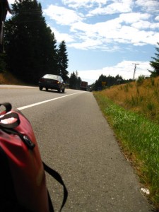
I would give directions to the multi use path, or MUP, system from Mukilteo, but I’m still not sure how we found it. I had directions printed off of Google Maps but after talking to a driver at the fruit stand where we stopped who said, “I’ve been delivering here for 15 years and I’ve never heard of Natures Path Road” we abandoned those and used the Droid to find another route. But after getting well and truly lost again we stopped at a fishing tackle store where we were told how to get to the Burke-Gilman trail. We got a few miles closer using his directions but still had to rely on the Droid for the last few miles.
We finally crossed Bothell Drive and were on the trail. A chatty Seattle cyclist lady gave us directions to the Sammamish Trail, but by thus time I was having none of it and decided to trust the Droid from here to Bellevue.
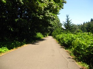
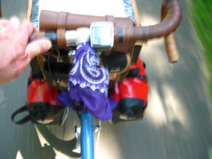
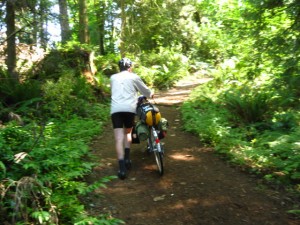
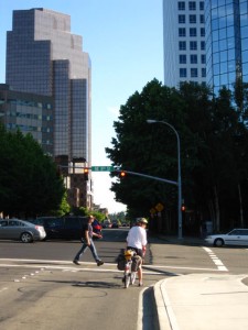
I have to give kudos to Seattle for their MUP system but I wonder if they could scrounge a few dollars more for some signage. Once we got on the Burke-Gilman we still were confused and took a number of wrong turns before we got to the Sammamish Trail and ultimately to the 520 Trail. But not before a detour over the Bridal Crest Trail, which is dirt and very steep. And then we literally were ejected onto a suburban neighborhood street with no idea where the trail went until we saw a bike rider appear from a barricaded abandoned road which was the access to the 520 Trail continuing toward Bellevue.
Once back to our starting point in Bellevue we both had to agree that this tour was a success. No mechanical failures and no major physical problems presented themselves. This is a spectacular part of the country. I really didn’t realize the extent of the rugged mountains and wilderness which exist so close to Seattle and which we could see in the distance every day of our ride. We plan to do some more bike touring here in the near future.
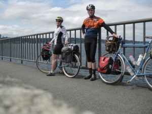
On the 28th of July we drove to Bellevue, WA to attend a relative’s wedding. On the 4th we are going to Sky King’s family reunion on Snoqualmie Pass. In the intervening days we are bike touring. Originally I was going to post a journal on crazyguyonabike, but that site has been down today while I’m updating so I decided to post the tour journal here too.
Once we are in the bike touring mode and all our gear is readily accessible and we’re mentally and physically ready, it is easy to sandwich in a 3 or 4 day tour. It doesn’t take a huge amount of planning and we were going to be in Seattle anyway. It’s not as if a person has to quit their job or even take major time off in order to go touring.
On the 31st we rode to the Seattle ferry terminal and took the Bainbridge ferry. From there we started riding towards Port Townsend via Fay Bainbridge State Park where we spent the night. Getting to the ferry terminal from Bellevue was a piece of cake on the I90 Trail and the Mountains to Sound Trail. The 305 out of the town of Bainbridge Island has a beautiful, wide shoulder with a nice surface but the amount of automobile traffic is astounding. It was only about 4 miles to the turn off on Day Road but the relative silence was immediately apparent as soon as we got off 305. Then it was a couple more bucolic miles to the state park.
Fay Bainbridge State Park is a wedge of land opening to Puget Sound and holding back housing developments on both sides. Weathered, beam straight cedar logs are spread out on the black volcanic sand, but not in a jumble, rather aligned with the shoreline up to the high tide water’s edge. The view of the sound and Mt Rainier and the Seattle Skyline and the North/Canadian Cascades is nothing short of breathtaking.
While in Bainbridge Island we hit the Safeway and bought beer and vegetables so we were able to make past primavera for dinner. This park only charges $5.00 per bicycle because they want to encourage that type of behavior and the showers are 25 cents for a minute and a half. Good place to stay!
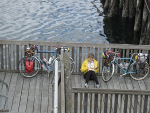
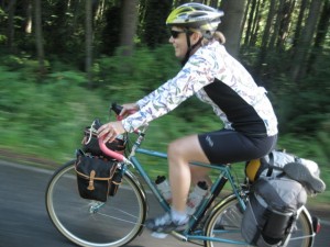
Overnight To Montour Report
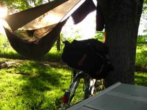
Well, the weather finally cooperated this weekend and we were able to complete our Boise-Montour-Boise overnight bike trip. We were attempting to find a passage over the foothills without traveling on the main highways. That didn’t exactly work out, but the adventure and the exploration were really the main point.
And the timing couldn’t have been better. It had been a difficult week and the combination of work-a-day events and everyday average life events were beginning to feel oppressive. Funny how halfway through the first day the thought patterns in the brain were beginning to be a little bit more objective and coherent. Such is the power of getting out on the bike!
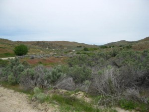
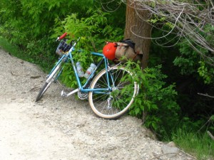
Eagle Road becomes Willow Creek road as one travels north from Eagle and about 17 miles from our front door it turns into dirt. A fairly well maintained dirt road which goes basically straight up for the next 8 miles, and becomes Pearl Road along the way. We were watching for a road which, according to Google Maps, veered off to the left shortly after the abandoned mining town of Pearl and wound back down towards Montour. We never saw this alleged road and finally ended up on Highway 55 just outside of Horseshoe Bend. Dropping down into Horseshoe Bend on the old highway and then about 11 miles on scenic highway 52 along the Payette River brought us to Montour. About 10 miles more than we had planned on, and the 47 total miles for the day took us almost 5 hours to ride. Luckily, we were able to replenish our carbohydrates and spirits at the general store!
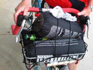
Being so replenished, and having set up the hammocks, we proceeded to cook our pasta primavera and to enjoy the sunny windless evening, with mosquitoes. Sitting in the sun and reading, we could have been anywhere….Texas, California or Croatia, and yet we were only a few hours from home.
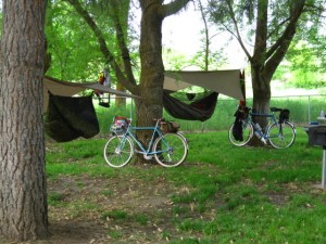
The next morning we decided to take the dirt road on the north side of the river into Emmett instead of taking the main highway. According to the campground host, the road was well maintained with little loose gravel and only one climb. Never listen to a cigarette smoking diesel pickup driving campground host. I’m sure the road is a piece of cake driving the pickup home from the bar in Emmett. It’s just that the climbs were numerous and sharp, and the washboard effect was in place on most of them….. heck of a way to start the day.
After a big breakfast in Emmett, the ride up Old Freezeout hill and then on highway 16 back into town was relatively uneventful. And so, with just a little bit of planning and just a little over 24 hours, we were able to get away for a little adventure, recharge and come back raring to go and ready for the next kick in the teeth.
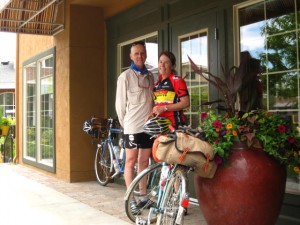
The weather looks a little sketchy for our planned Memorial Day overnight bike trip so it may be postponed one week. Not that it’s going to be horrible weather, but it will be more fun when a little warmer. Maybe I should call this Fair Weather Bike Touring News?
Sky King’s bike is ready to go.
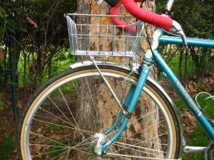
Grant Petersen at Rivendell pioneered the use of an inexpensive wire basket zip tied to a Nitto rack for overnight bike tripping. Sort of primitive but it looks like it should work. (Notice I’m letting Sky King do the experiment)
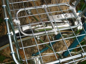
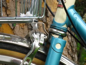
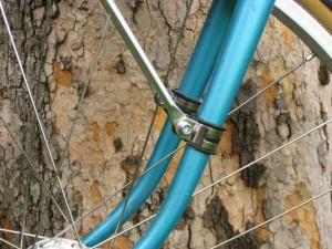
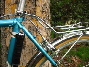
The Nitto R10 Bag Supporter is a real minimalist rack but she is just going to use it to support a large rear saddlebag and a sleeping bag.
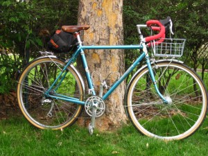
While almost any bike can be used for an overnight trip,Sky King’s bike, Sky, sports road style drop handlebars, bar end shifters, a triple crankset with an 8 speed cassette and relatively voluminous tires about 34 to 35 millimeters wide. The wider tires will offer some cushion on the gravel roads we will be traversing. The small front chainring with 26 teeth combined with a large rear cog of 32 teeth provides a low gear of 21 which should get her up any of the hills we will encounter. (see my post about gear inches to see what that means)
More about the actual packing, the Bike Hermits setup and the route will be the subject of future posts.
